Greenland’s ice sheet is the second largest mass of ice on Earth, containing enough water to raise ocean levels by about 20 feet. The ice sheet has been losing mass over the past two decades and warming temperatures will mean more losses for Greenland. Scientists are studying ice from different climate periods in the past to better understand how the ice sheet might respond in the future.
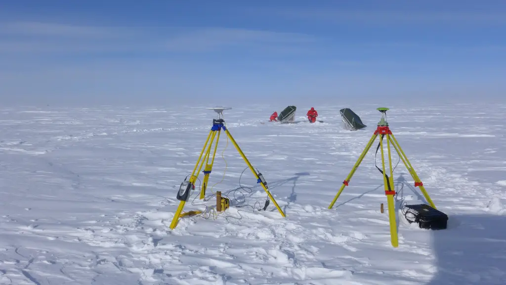
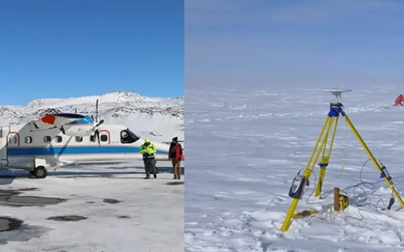
Installation of Radae Reflectors
Credit: DLR
The Greenland ice sheet is, in places, more than three kilometers thick and a crucial feature in climate modeling. One way of studying Greenland’s ice sheet is the new radar imaging process.
Scientists from the German Aerospace Center (Deutsches Zentrum für Luft- und Raumfahrt; DLR), together with colleagues from ETH Zurich (Eidgenössische Technische Hochschule Zürich), are currently conducting tests of a new radar imaging process in a research flight campaign over Greenland.
This technique will allow aerial measurements of three-dimensional snow and ice conditions at depths of up to 50 meters.
“In the long term, it should be possible to determine the impact of climate change on the internal stratification of snow, firn (partially compacted snow) and ice,” explains Irena Hajnsek, Project Manager of the ARCTIC15 campaign.
“This new radar technology will enable us to, in the future, recognize the various types of ice and snow from the air or from space,” says Campaign Manager Ralf Horn from the DLR Microwaves and Radar Institute. “Different types of ice reflect the radar signals differently and the DLR F-SAR is able to detect these differences – sometimes at depths of up to 50 metres.”
To understand the effect of climate change this is interesting to, for example, investigates how much water from the snow that melts on the surface freezes again during infiltration and thus does not contribute to sea level rise.
The Aircraft is fitted with a Synthetic Aperture Radar (SAR), will fly over each of five study areas in southern Greenland several times during the approximately six-week campaign, which lasts until the end of May.
“Flying over Greenland’s permanent ice is something special,” says DLR pilot Thomas van Marwick. “The vast distances between landing facilities and the sometimes extreme weather conditions must be carefully taken into account.”
The flights usually last between four and five hours; on the longer routes they sometimes include stopovers for refueling.
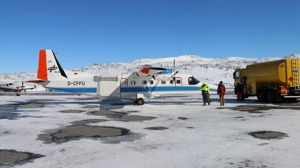
DLR Do 228-212 Research Aircraft D-CFFU
Credit: DLR
The ice covering Greenland reveals varying structures, depending on the region being examined. The central and high-altitude areas experience hardly any snowmelt in the summer, forming a firn layer tens of meters in thickness, which is converted to ice by the pressure of the overlying layers. In contrast, exposed ice is found near the coast; it has low snow cover only in the winter. An examination of the depth of the ice is, at the same time, a glimpse of the climate over the last few decades, because successive ice layers have formed over the years.
The study justifies the hard work of team, such as exploration of remote areas, installation of radar reflectors and examination of firn and ice in extreme temperature of below minus 25 degrees Celsius and strong winds.
On the basis of this research campaign, the researchers are planning to develop new methods for snow and ice study and analysis, which will then be applied to the data gained from future satellite missions such as Tandem-L. This is expected to empower the use of space technology for glaciers and ice mapping and monitoring. At present, this can only be determined in select locations through complex expeditions.
Related News:
NASA First Ever Mapped Greenland’s Ice Sheet in 3D