
Posts From GIS Resources

eGIS Associates designated an Esri Release Ready Specialty Partner
Dacula, Georgia, January 30, 2019 – eGIS Associates is excited to announce that we have been designated as a Release Ready Specialty partner by Esri. The Release Ready Specialty identifies

German DIN Supports Foundations of Datacubes
January 2019 – What is a coverage, after all? This fundamental spatio-temporal data structure, encompassing (among others) datacubes, is widely used, based on adopted and implemented OGC and ISO standards

One Stop Geospatial Search Engine
Contributed By: Note: Here, URLs mean link of documents, examples, scripts, downloadable geospatial data, geospatial services, tools, templates, web applications and mobile apps etc. which are in PUBLIC domain (i.e. available online). Geospatial

Successful Launch of Formation-Flying Microsatellite Constellation Built by Space Flight Laboratory
TORONTO, Ontario, Canada, 7 January 2019 – Space Flight Laboratory (SFL) announced the successful launch of three formation-flying microsatellites built by SFL under contract to Deep Space Industries for HawkEye
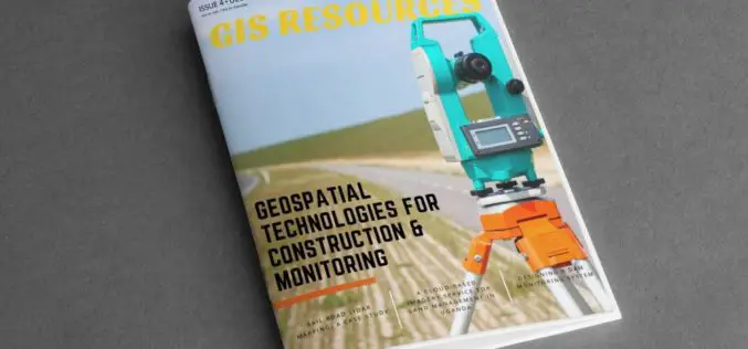
GIS Resources Magazine (Issue 4 | December 2018): Geospatial Technologies For Construction & Monitoring
GIS Resources Magazine (Issue 4 | December 2018): Geospatial Technologies For Construction & Monitoring December 19, 2018 – GIS Resources, a leading global platform for latest and high-quality information source of the
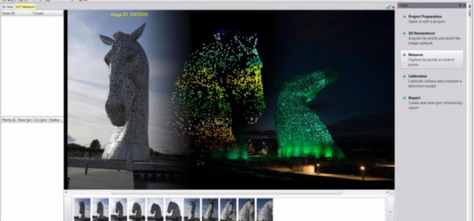
Trimble Inpho UASMaster 9.1 Now Available
UASMaster is one of Trimble’s UAS processing software solutions. UASMaster is engineered on the basis of the well-established Inpho advanced airborne photogrammetry/airborne LiDAR processing software suite. It offers full automatic geo-referencing, point-cloud

Photography Is the Story I Fail to Put Into Words – Destin Sparks
Authored By: I love nature, I like to give an intense look at creativity, innovation and amazing architectures. When I look at all these, I wish my family, friends

Echolocation And Its Technological Developments
Authored By: Introduction Dolphins utilize echolocation to discover things in their surroundings. The clicking-noises they utter bounce off things under the water & goes back to this smart mammal.

Public/Private Datacube Partnership Launched
Datacubes are trending, and with the rasdaman datacube engine, they can even be federated across data centers. Users benefit from location transparency and planetary-scale fusion services. Now public and private
HARRIS Geospatial Solutions Webinar: The Applications and Benefits of Synthetic Aperture Radar (SAR)
Synthetic Aperture Radar (SAR) is rapidly becoming a key dataset in geospatial investigation. Unlike many other observational methods, SAR is not limited by illumination or cloud cover. In recent years,
