
Posts From GIS Resources
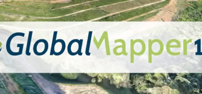
Global Mapper v19.1 Now Available
Global Mapper v19.1 Now Available with 3D Profile Line Exporting, Multivariate Querying, and Expanded Drag-and-Drop Window Docking Blue Marble Geographics is pleased to announce the release of Global Mapper version
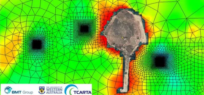
Satellite Derived Bathymetry from TCarta Plays Key Role in Aquaculture Siting Project
Fish Farms in Arabian Gulf BRISTOL, United Kingdom, February 14, 2018 – British Engineering and Scientific Consultancy Firm, BMT, is using Satellite Derived Bathymetry from TCarta as a critical dataset
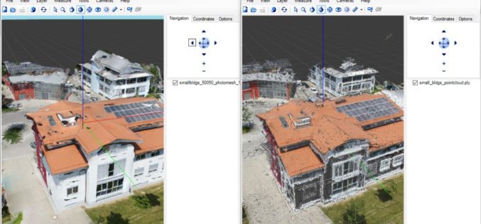
ICAROS Uses TatukGIS SDK to Develop Integrated Aerial Geospatial Data Viewer
Aerial geospatial solutions provider, Icaros, Inc., selected the TatukGIS Developer Kernel (DK) to develop the next generation geospatial data viewer component of its OneButton™ software product, which is used to

OGC Announces Earth Observation Exploitation Platform Hackathon 2018
Hackathon will test the readiness of new, interoperable cloud-deployment architectures for processing of Earth Observation data February 13, 2018 – The Open Geospatial Consortium (OGC) is calling for participation in its
AirGon LLC Appointed North American Distributor for YellowScan Drone LiDAR Systems
Montpellier, February 13, 2018 – AirGon LLC, a wholly owned subsidiary of GeoCue Group Inc., has been appointed the North American Distributor for YellowScan based in Montpellier, France. Under the agreement, AirGon

Punjab to Launch Mobile App for Farmers to Manage Crop Residue
Chandigarh Feb 11, 2018 (PTI) – To help in management of stubble, the Punjab government today said it will launch a mobile app to facilitate the farmers for custom hiring

PrecisionHawk Acquires Droners.io and AirVid to Launch the Nation’s Largest Network of Commercially Licensed Drone Pilots
PrecisionHawk will merge the two companies under the Droners.io name and platform to support the delivery of on-demand, drone-based imagery to its enterprise clients Raleigh, NC – February 8, 2018

OGC Requesting Responses to its Portrayal Concept Development Study
This new OGC CDS is the first step in improving the way that geospatial data is visually represented in web maps February 7, 2018 – The Open Geospatial Consortium (OGC) announces
NASA ARSET Training: Introduction to Using the VIC Hydrologic Model with NASA Earth Observations
Introduction to Using the VIC Hydrologic Model with NASA Earth Observations Dates: Thursday, February 15, 2018 to Thursday, March 1, 2018 Times: 9:00 – 10:00 a.m. and 6:00 – 7:00 p.m. EST (UTC

GfK Releases New Digital Maps for Australia
GfK has released a new, completely overhauled map edition for Australia. Along with more detailed coastlines, the new digital maps reflect the latest status of the country’s more than 57,000
