NetCDF Support in Most Recent Release of OpenGeo Suite Handles Multi-dimensional, OGC-Compliant Meteorological Data Analysis
![]() Washington, DC – February 2, 2016 – Boundless, the leading provider of open source geospatial software and services, today highlighted the inclusion of NetCDF Support for Atmospheric Data in its latest release of the OpenGeo Suite, Version 4.8. Developed in collaboration with Boundless partner GeoSolutions at the behest of a North American customer, NetCDF support enables OpenGeo Suite users to perform more powerful analysis of atmospheric and meteorological data.
Washington, DC – February 2, 2016 – Boundless, the leading provider of open source geospatial software and services, today highlighted the inclusion of NetCDF Support for Atmospheric Data in its latest release of the OpenGeo Suite, Version 4.8. Developed in collaboration with Boundless partner GeoSolutions at the behest of a North American customer, NetCDF support enables OpenGeo Suite users to perform more powerful analysis of atmospheric and meteorological data.
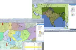
NetCDF (Network Common Data Format), developed by Unidata, is a set of software libraries and self-describing, machine-independent data formats that support the creation, access, and sharing of array-oriented scientific data – most commonly atmospheric and meteorological data. Regarded as one of the most useful data formats for weather, OpenGeo Suite version 4.8 is able to consume and visualize NetCDF data as well as GRIB datasets on a true multi-dimensional, OGC-compliant basis, permitting simultaneous analysis of a variety of data vectors. Traditional geospatial tools claiming NetCDF support can only enable analysis on a layer-by-layer basis, while OpenGeo Suite now supports analysis across more than 2 axes at the same time. As an example, analysts can now examine changes in air temperature at different times across a variety of altitudes at once, when other solutions can only examine a single altitude at a time.
“We’re very pleased to be able to respond to customer requests for enhanced technology in the Suite platform,” noted Tom Ingold, Boundless Vice President of Products. “NetCDF support will enable customers ranging from weather providers to consumers to visualize and analyze weather data to better support their business requirements, and is the latest example in the growing value of open source geospatial software.”
NetCDF support is available for download today as part of the OpenGeo Suite from boundlessgeo.com
About Boundless
Boundless is the leader in commercially supported, open source, geospatial software. OpenGeo Suite enables a feature-rich, enterprise GIS without the high licensing costs associated with proprietary software. The experts at Boundless reduce the cost and time of deploying and managing spatial software with packaging, support, maintenance, professional services, and expert training. Learn more at boundlessgeo.com