
Remote Sensing
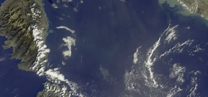
First Earth Colour Data Released by Sentinel-3A
20 October 2016 – The Copernicus Sentinel-3A satellite has taken another step towards being fully ‘operational’ as the first data from its Ocean and Land Colour Instrument are made available
Benefits and Potential of RADAR Satellites: TerraSAR-X and TanDEM-X
The German satellite duo TerraSAR-X and TanDEM-X have consistently delivered one-of-a-kind Earth observation data since 2007 and 2010, hence shaping the international research landscape. TanDEM-X is being implemented on behalf of

DataMapper Launches New Drone Data App – Waterpooling App
In the aftermath of an extreme rain event, insurance adjusters and growers have had to spend a significant amount of time in the field to approximate the extent of damage.
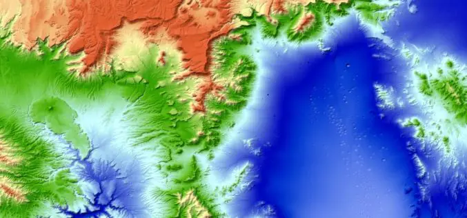
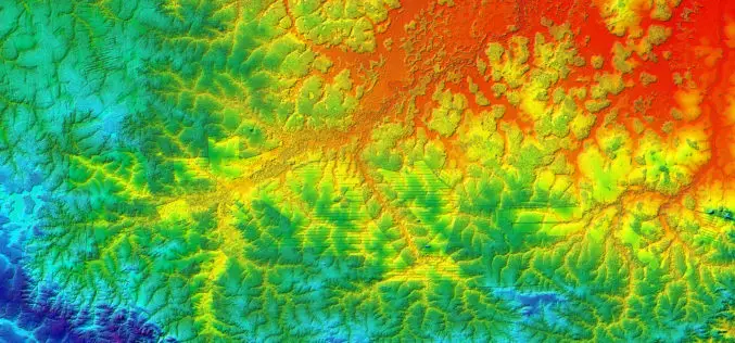
New 3D World Map – TanDEM-X Global Elevation Model Completed
The new three-dimensional map of Earth has been completed. Mountain peaks and valley floors across the globe can now be seen with an accuracy of just one metre. The global
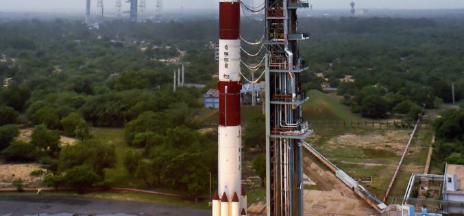
India Successfully Launches SCATSAT-1 – Satellite for Weather Forecasting
SCATSAT-1 is a global mission and data generated from the Scatterometer, developed by ISRO will also be utilised by the American space agency NASA and European Space Agency organisation, EUMETSAT
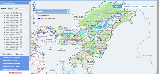
NRSC Released Updated Flood Hazard Atlas for Assam State
According to recent news by ISRO, the National Remote Sensing Centre (NRSC), ISRO, Hyderabad has released updated flood hazard atlas of Assam, a highly flood-prone state of India. Assam is
UAE to Adopt Space Technology for Farming
According to the recent news reported by the Gulf News, the UAE Space Agency has recently hosted senior Japanese officials at its Abu Dhabi headquarters for talks on applying space

Training Course on GIS and Remote Sensing For Climate Change Impact Analysis and Adaptation
Training Course on GIS and Remote Sensing For Climate Change Impact Analysis and Adaptation October 10 – October 14, 2016 This training will offer a set of methods and techniques
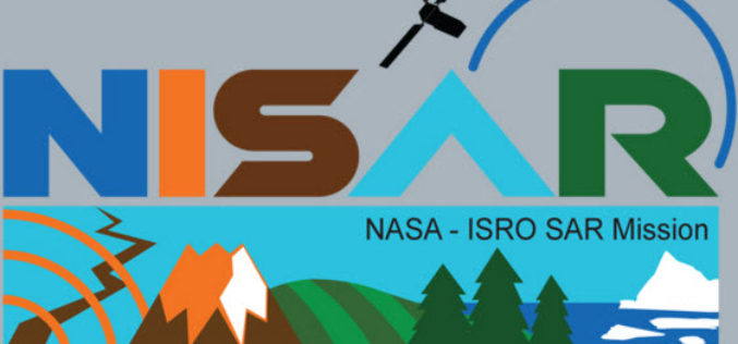
NISAR – NASA-ISRO Synthetic Aperture Radar Mission
According to recent by The Indian Express, the Indian Space Research Organisation (ISRO) and NASA’s Jet Propulsion Laboratory are jointly working on the development of a Dual Frequency (L&S band)
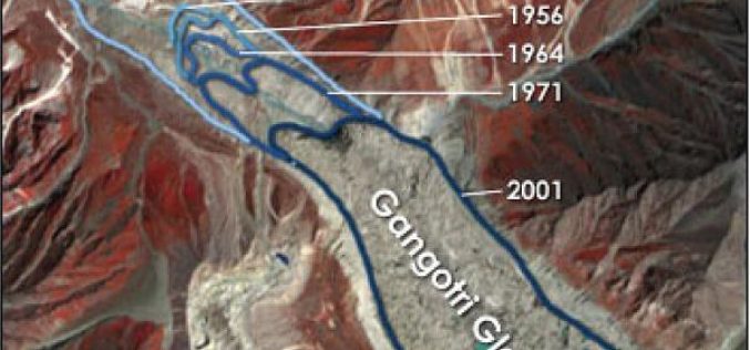
Remote Sensing Studies Reveals That Glaciers are Melting at 5 to 20 metre Rate Annually: India
New Delhi, Jul 19 (PTI) – Majority of glaciers in India including Gangotri are melting at varying rates ranging from five to 20 metre per year, the government today told
