
Remote Sensing

World’s Biggest Aerial LiDAR Survey to Reveal Angkor Wat Historical Secrets
Angkor, in Cambodia’s Northern Province of Siem Reap, is one of the most important archaeological sites of Southeast Asia and listed in world heritage sites by UNESCO. Stretching over some

Tribal Ministry to Use Satellite Mapping to Develop Water Bodies
The Ministry of Tribal Affairs (MoTA) is planning to use satellite mapping to identify potential water collection spots, which could be developed for fish culture and other purposes in order
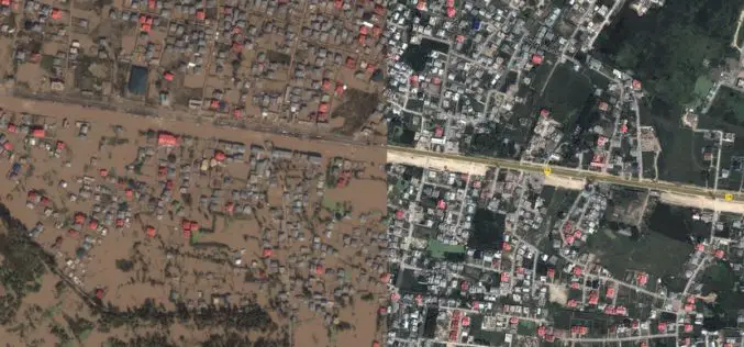
Kashmir Floods Monitored By Latest Satellite Technology
Union Minister Jitendra Singh said that Kashmir floods are being constantly monitored by latest satellite technology at the National Remote Sensing Centre. “Kashmir floods are being constantly monitored by latest
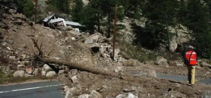
Aerial LiDAR to Study Impact of Colorado Flood on Soil Erosion
Anderson and colleagues use repeat aerial LiDAR to quantify the erosional impact of the heavy rains that inundated the Colorado Front Range in September 2013. One week of steady rain and

IRNSS-1D, 4th Satellite of IRNSS Constellation Launched Successfully
Today (Mar. 28, 2015) ISRO’s Polar Satellite Launch Vehicle, PSLV-C27, successfully launched IRNSS-1D from Satish Dhawan Space Centre, Sriharikota. The satellite is one among the seven of the IRNSS constellation

India Turns to ‘Satellite God’ for Crop Monitoring
(Reuters) – Sher Singh, a farmer from desert state of Rajasthan, prays to Varuna, the Hindu god of water, for a bountiful harvest. Now, he is also looking to the

Malaysia is Using LiDAR to Detect and Predict Natural Disasters
In recent news by BERNAMA (Malaysian National News Agency), Malaysia is currently using a sophisticated system called ‘Light Detection and Ranging’ (LiDAR) to detect and predict natural disasters for managing disasters more efficiently
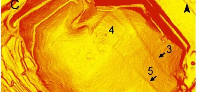
Airborne LiDAR Led To the Discovery of an Early Roman Fortification System
An interdisciplinary study by Federico Bernardini et.al., airborne light detection and ranging (LiDAR), ground penetrating radar (GPR), and archaeological surveys of the archaeological landscape of the Trieste area (northeastern Italy),
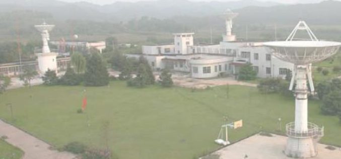
China to Setup Satellite Data Receiving Station in the Arctic
In a recent news by CRI English, China is working to setup its first overseas satellite data receiving station in the Arctic. The station, which is expected to start operation

Airborne LiDAR Reveals Maya Civilization Landscape
The Maya civilization was one of the most dominant indigenous societies of Mesoamerica (a term used to describe Mexico and Central America before the 16th century Spanish conquest). The earliest Maya settlements
