
Remote Sensing
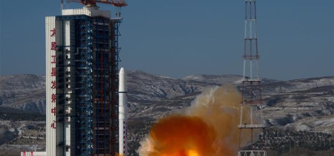
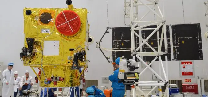
China Launches Two SuperView-1 Remote Sensing Satellites
According to recent news reported by the Xinhua, China launches SuperView-1 03/04, a pair of 0.5-meter high-resolution remote sensing satellites, from the Taiyuan Satellite Launch Center in north China’s Shanxi Province, Jan.
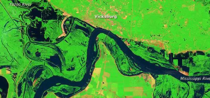
Open Source Satellite Images in Flood Monitoring. Do We Need a Liberal Spatial Data Policy During Disasters…?
Contributed by: The predictions of the meteorological department regarding the onset of natural disasters and the actual incidences of natural calamities were failed to converge in most of the situations

Satellite Data for Spatial Mapping of Marine Fisheries
Kochi, India – According to recent news reported by The Hindu, The Central Marine Fisheries Research Institute (CMFRI) will make use of remote sensing satellite data for the spatial mapping of
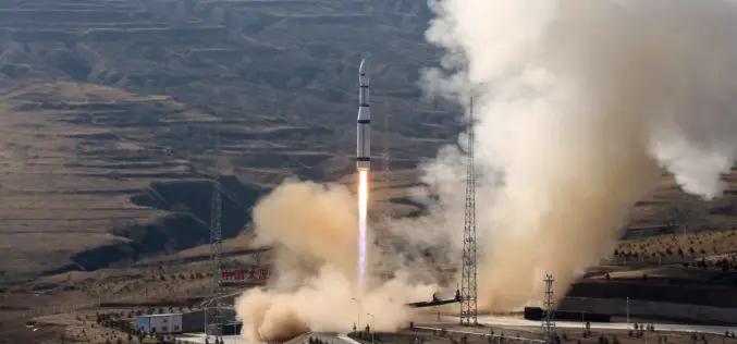
China Launches Three Remote Sensing Satellites – Jilin-1-04, Jilin-1-05 and Jilin-1-06
November 21 (ANI): China has launched three remote sensing satellites to promote commercial use for the remote sensing industry. The satellites — Jilin-1-04, Jilin-1-05, and Jilin-1-06 — were carried by a

Remote Sensing Technology Employed in Iran to Identify Archaeological Sites
Iran – According to recent news reported by the Financial Tribune, for the first time in the annal of Iranian technological history, remote sensing techniques have been employed to study and identify
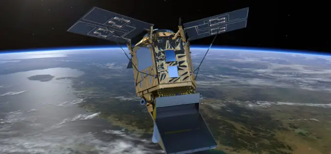
Sentinel‑5P – First Copernicus Mission Dedicated to Monitoring Our Atmosphere
October 13, 2017 – The first Copernicus mission dedicated to monitoring our atmosphere, Sentinel‑5P, has been launched from the Plesetsk Cosmodrome in northern Russia. Sentinel-5P belongs to the Copernicus satellite fleet,
China Launched the 2nd Remote Sensing Satellite for Venezuela
According to recent news reported by Sputnik, China launched the second Venezuela Remote Sensing Satellite (VRSS-2) using a Long March-2D (Chang Zheng-2D) launch vehicle on October 09, 2017. Also known by
Pakistan to Launch First Remote Sensing Satellite in 2018
According to recent news by the Geo.tv, the Pakistan Space and Upper Atmosphere Research Commission (Suparco) has recently announced that Pakistan’s first optical remote sensing satellite PRSS-1 would be launched in 2018. The
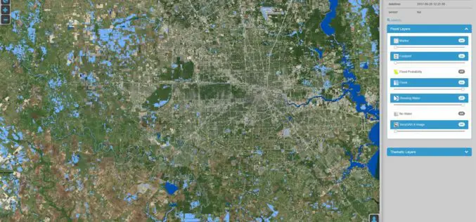
DLR Provides Satellite Data for Hurricane Harvey
DLR provides satellite data for Hurricane Harvey Radar images from TerraSAR-X German Aerospace Center (DLR) provides real-time recordings and archive data of the German radar satellite TerraSAR-X. DLR supports hurricane
ISRO: Haze Removal Algorithm Developed for Cartosat Images
ISRO – High-resolution optical imaging Earth Observation Satellite (EOS) systems such as CARTOSAT provide multi-spectral remote sensing data in the visible and near-infrared (VNIR) wavelengths of the order of sub-meter
