According to CRIEnglish.com, China has successfully launched the Yaogan-27 remote sensing satellite into a scheduled orbit at 10:31 a.m. Beijing Time on Aug. 27,2015 from Taiyuan launch site in Shanxi Province, north China.
The satellite will mainly be used for experiments, land surveys, crop yield estimates and disaster prevention. Yaogan-27 was carried by a Long March-4C rocket, the 207th mission for the Long March rocket family.
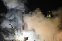
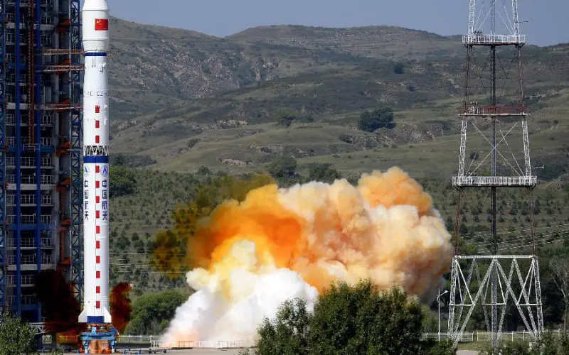
![A Long March-4C rocket carrying the Yaogan-27 remote sensing satellite blasts off from the launch pad at the Taiyuan Satellite Launch Center in Taiyuan, capital of north China's Shanxi Province, Aug. 27, 2015. The satellite will mainly be used for experiments, land surveys, crop yield estimates and disaster prevention. [photo:Xinhua/Yan Yan]](http://www.gisresources.com/wp-content/uploads/2015/08/Yaogan-27-Earth-Observation-Satellite.jpg)
A Long March-4C rocket carrying the Yaogan-27 remote sensing satellite blasts off from the launch pad at the Taiyuan Satellite Launch Center in Taiyuan, capital of north China’s Shanxi Province, Aug. 27, 2015. The satellite will mainly be used for experiments, land surveys, crop yield estimates and disaster prevention. [photo:Xinhua/Yan Yan]
China launched the first “Yaogan” series satellite, Yaogan-1, in 2006.
As was the case with previous launches of the Yaogan Weixing series, western analysts believe this class of satellites is being used for military purposes.
In fact, three types of satellites use the Yaogan designation. All with a basis for military purposes, these satellites are used for space-based synthetic aperture radar observations, electro-optical observations and naval oceanic surveillance.
Related News:
- Back to Back – China Launches Yaogan-25 Earth Observation Satellite
- China Launches Yaogan-24 Earth Observation Satellite
- China Launches Yaogan-23 Earth Observation Satellite
- China Launches Yaogan-22 Remote Sensing Satellite
- China Launches Remote Sensing Satellite – Yaogan-21
- China Successfully Launches Yaogon XX Remote Sensing Satellite
- China Launches Remote Sensing Satellite – Yaogon XVIII
- China Sends Remote-Sensing Satellite into Space – Yaogon XVII