Drone Bombings in the Federally Administered Tribal Areas: Public Remote Sensing Applications for Security Monitoring
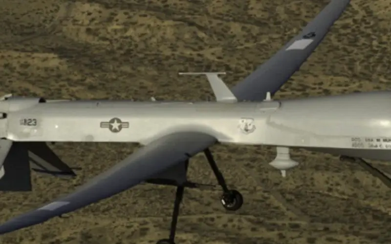
Drone bombing, as a US defense strategy in Pakistan, began under the George W. Bush administration as part of the “US War on Terrorism” and aimed to defeat Taliban and al-Qaeda militants who have sought refuge in the Federally Administered Tribal Areas (FATA) of North West Pakistan. The strikes, which have continued under the Obama administration, are carried out by unmanned aerial vehicles (UAVs), and are primarily operated remotely from Creech Air Force Base in Nevada.
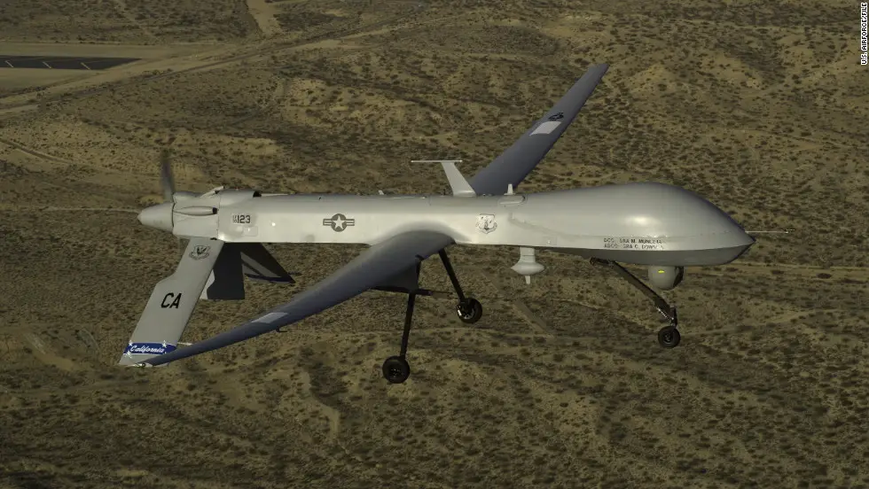
Photo Credit: CNN
Since 2001, Taliban and al-Qaeda activity has increased significantly in the region, triggering US security concerns. The FATA has become a safe haven for the Taliban, prompting US security officials to reassess their Middle East policy. The Taliban, if left unchecked, could disrupt the progress that the US has made in neighboring Afghanistan. Currently, it is difficult to collect field data from the FATA and most of what is known about the distribution and densities of drone bombings is from second hand sources on the locations of bombings, extent of damage, and impacts in the region would be of use for the political science community to assess the current impacts of drone bombings. Indeed, the United States government has not confirmed the use of drones in FATA or information on the impacts of drone bombings.
Introduction:
There has been an increasing interest in near real-time satellite imagery that can be used to assess contemporary political geography questions. One of the current advantages of using remote sensing in political geography is that it can collect imagery of the earth in regions where it is very difficult to collect field data. For instance, it is now possible to study genocide in Darfur by quantifying the number of destroyed structures in villages in southern Sudan with high-resolution commercial imagery. Currently, there are a number of commercial satellites that can provide sub-meter resolution imagery (QuickBird, IKONOS, OrbView, GeoEye) from space. This has allowed researchers to address questions that previously were impractical to study from space or on the ground.
This research examines the utility of satellite imagery to identify the location and extent of damage from drone bombings in the Federally Administered Tribal Areas. First, research team identify the regions with the highest incidence and density of drone bombing activity. Second, team systematically search the area to see if there is any evidence of bombing damage and determine the exact locations of US military air strikes. Finally, team assess the potential for satellite imagery to monitor the region in order to increase transparency and security in the region.
Study Area:
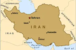
The Federally Administered Tribal Areas (FATA) of Pakistan are home to attacks carried out by the US military in an attempt to eradicate al-Qaeda and Taliban militants. There are seven tribal areas known as agencies in the Federally Administered Tribal Areas: Bajaur, Mohmand, Khyber, Orakzai, Kurram, North Waziristan and South Waziristan and six smaller zones called Frontier Regions. The region contains rugged mountains, barren hills, and deep valleys with most human habitation in open valleys in extensive floodplains where soil is fertile and tributaries provide irrigation water.
Methodology:
GIS and Remote Sensing Methods
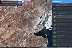
Data on the location of potential drone bombing was collected from the Center for American Progress, which provides estimated location and casualty data for the FATA. The locations of potential drone bombing from 2004 to December 31, 2009 were entered into ArcMap 9.2. The region with the highest number and density of drone bombings was identified, and a QuickBird 2 image was purchased from GeoEye over the region. QuickBird 2 provides 0.41 m resolution data in the panchromatic and 1.65 meter data in the multi-spectral. A clear image was purchased from November 9, 2009 (ID:101001000A95C201). Areas that did not contain structures (i.e. natural areas) were cut to reduce the cost of the imagery and to focus on structures in the region. The image cost was $1200 for a 10.6 Sqkm area and allowed a sufficient view of individual structures (Fig. 1). The image was sent in a GeoTIFF format and was uploaded into ENVI 4.8 software.
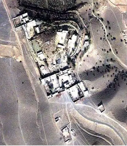
Fig. 1. An example of structures in the FATA region from QuickBird 2 imagery.
A systematic search was undertaken in 1 Sqkm grids to identify structures that showed potential damage from drone bombings. Searches began in the upper left hand corner of each grid and continued east until reaching the eastern most section of the grid or where the image was subset. A 100 m by 100 m window was used to examine the structures for potential drone damage. Potential sites were marked as regions of interest in vector files, and then examined by all authors to assess if there were bombed sites. Once potential bombed sites were identified, team examined publicly available Google Earth imagery to identify if there was high-resolution imagery before and after November 2009.
Results:
There were 16 drone bombings in Miram Shah in North Waziristan before January 1, 2010 (Fig. 2).
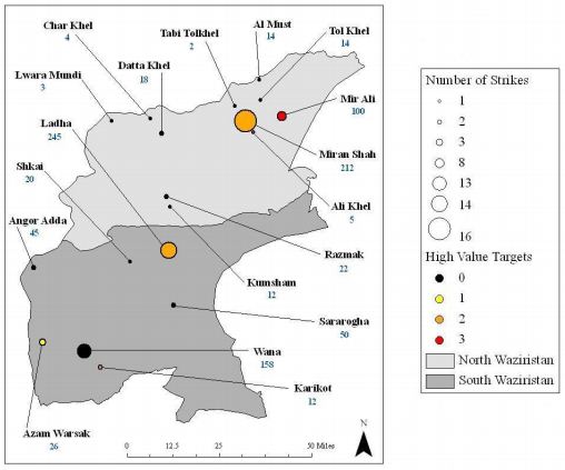
Hypothesized location of drone bombings and casualties (blue) before December 31,
2009.
There were an estimated 212 people killed in Miram Shah, which was the highest number in all cities in the FATA. A systematic search was undertaken of the acquired QuickBird 2 image in 1 Sqkm grids that contained potential drone bombing sites (Fig. 3).
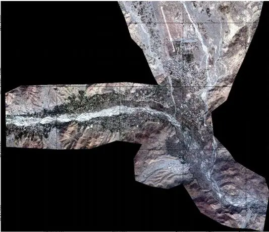
Fig. 3. QuickBird 2 imagery with 1 km grid lines of Miram Shah, North Waziristan.
Research team identified two structures as potential sites where a drone bombing might have occurred (Fig. 4). Fig. 4A is an irregular structure with wall damage in the center of the structure. However, it is difficult to determine if this is damage from a drone bombing or decay of a structure that has been abandoned. If it is a drone bombing it could be over 6 months old.

Fig. 4 A. Potential drone bombing sites from November 2009 QuickBird 2 image.
Fig. 4B does appear to be a recently bombed site. There is an unusual plume of sediment away from the structure in the North and burned area damage in black. The blast radius is less than 15 m and the outer walls are still intact. There was no high-resolution available from Google Earth from before or after November 2009 for the two potential bombed sites.
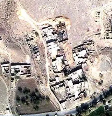
Fig. 4 B. Potential drone bombing sites from November 2009 QuickBird 2 image.
Conclusions:
It is possible for the public to monitor drone bombings in the Federally Administered Tribal Areas of Pakistan. However, monitoring and comparing quality of life indicators in the Federally Administered Tribal Areas and southern Afghanistan using a diversity of satellites may have a more profound impact on the general public and policymakers. Results suggest that there should also be some concern with how the use of drones is further “technologizing” warfare and violating Pakistan’s territorial sovereignty, which is a problem for the Pakistan government and helps portray the US as interventionist without invitation. The continued use and development of drone technology may open the door to counterattacks on the US from whoever gets access to the technology, thus further escalating the “US War on Terrorism” without any effort at finding a political solution to it.
Citation:
Katrina Laygo, Department of Geography University of California Los Angeles Los Angeles, CA 90095-1524; Thomas W. Gillespie, Department of Geography University of California Los Angeles Los Angeles, CA 90095-1524; Noel Rayo, Department of Political Science University of California Los Angeles Los Angeles, CA 90095-1524; Erin Garcia, Department of Geography University of California Los Angeles Los Angeles, CA 90095-1524
Journal of Geographic Information System, Vol.4 No.2(2012), Article ID:18766,6 pages DOI:10.4236/jgis.2012.42018