 The U.S. Federal Emergency Management Agency has issued Guidelines for Coastal Flood Hazard Analysis and Mapping for the Pacific Coast of the United States.
FEMA’s mission is to support citizens and first responders to ensure that as a nation, together can build, sustain and improve our capability to prepare for, protect against, respond to, recover from and mitigate all hazards.
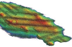
FEMA is responsible for preparing flood hazard maps that delineate hazard zones and Base Flood Elevations in coastal areas of the United States. Coastal areas are subject to a variety of natural processes that result in significant hazards to public safety and property along the Nation’s coastlines, including extreme conditions of storm surge flooding, waves, erosion, rainfall, and wind.
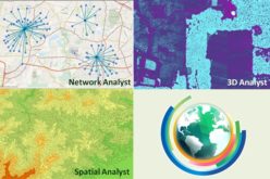
Guidance documents provide best practices for FEMA’s Risk MAP program. These guidance documents are intended to support current FEMA standards and facilitate effective and efficient implementation of the program. All guidance documents were written to support FEMA standards, but not only constraint to them. Alternate approaches that comply with standards that support program objectives are also acceptable.