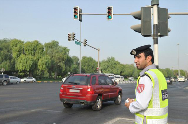
 In recent news, Abu Dhabi is using a unique intelligence system “Intelligent Safety Management System” which uses Geographical Information System to create solutions for certain problems such as speeding and red light violation.
The Intelligent Safety Management System will be using information gathered by road monitoring devices and generate number of solutions to help combat these issues.
“This system is the first of its kind in the world. It will use Geographic Information System (GIS) which has helped us manually create solutions for certain problems in the past such as speeding and red-light violations,” said Dr Atef Gareeb, roads and traffic expert at Abu Dhabi Police, speaking on the sidelines of the first International Road Traffic Accident Conference which took place in the capital on Monday.
“GIS was very efficient because it aided us in studying which areas in Abu Dhabi have the highest number of accidents, and based on that we placed speed monitors in a practical, calculated manner. We were also able to dispatch patrols in high-risk zones and advise officers to look out for 15 to 20 major violations which are normally associated with higher death rates,” he added.
Source: Gulf News