![]() Global Fishing Watch is the product of a technology partnership between SkyTruth, Oceana, and Google. Global Fishing Watch is a technology platform that uses satellite data to inform the public about all of the trackable fishing activity in the ocean and make global fishing activity more transparent.
Global Fishing Watch is the product of a technology partnership between SkyTruth, Oceana, and Google. Global Fishing Watch is a technology platform that uses satellite data to inform the public about all of the trackable fishing activity in the ocean and make global fishing activity more transparent.
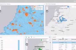
This interactive web tool is currently in prototype stage and is being built to enable anyone in the world to visualize the global fishing fleet in space and time. The web tool- Global Fishing Watch will disclose the intensity of fishing effort around the world, one of the stressors contributing to the precipitous decline of our fisheries.
The oceans are under a greater threat than ever before. According a 2014 report by the United Nations Food and Agriculture Organization nearly one-third of marine fish stocks worldwide have been overfished, and over 90% of the world’s fisheries are fully exploited or over-fished. And the impact of global overfishing is deterioration ocean ecosystems.
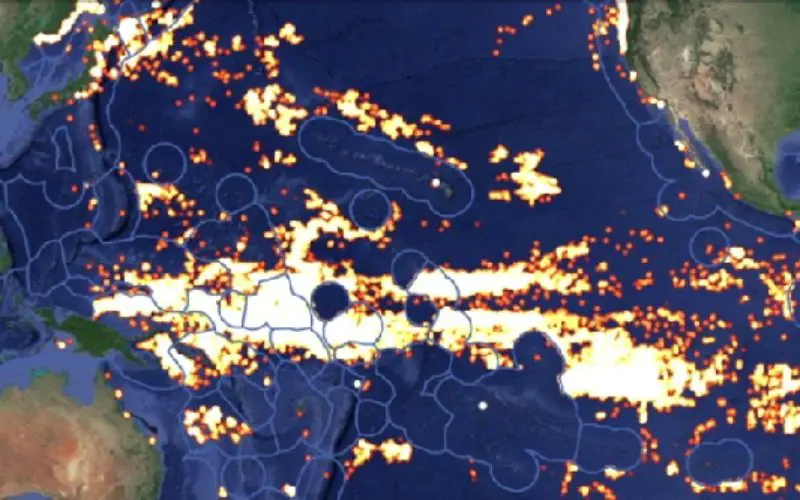
The tool makes use of Google’s mapping software and servers to display the tracks followed in 2012 and 2013 by some 25,000 ships that were either registered as large commercial fishers or were moving in ways that strongly suggest fishing activity.
While that data is from 2012-2013, the plan is to create a publicly available service to track large fishing vessels in near real-time to give authorities the ability to quickly identify illegal fishing activities, conservationists say.
The platform works by analyzing data points from the Automatic Identification System (AIS) network. AIS, basically a GPS broadcast of a ship’s location, was primarily designed as a safety mechanism to avoid collisions at sea, but information about the vessel’s behavior can be derived by analyzing the identity, speed and direction of broadcasting vessels. Global Fishing Watch removes all the cargo ships and other non- fishing vessel activity, providing an unprecedented view of human interaction with the ocean.
Global Fishing Watch system can’t pinpoint boats that aren’t registered with the global automatic identification system (AIS) or those that choose to “go dark” before entering restricted waters, the hope is the watch system can be an important tool to encourage fishing fleets to operate within international law, Google said.
The prototype visualization contains 300 million AIS data points covering over 25,000 unique vessels. For the initial fishing activity map, the data is limited to 35 million detections from 3,125 vessels that we were able to independently verify were fishing vessels. Global Fishing Watch then displays fishing effort in terms of the number of hours each vessel spent engaged in fishing behavior, and puts it all on a map that anyone with a web browser will be able to explore.
Global Fishing Watch will help bring back the world’s fisheries, protecting and enhancing the livelihoods of the hundreds of millions of people who depend on ocean fisheries for food and income.
“Global Fishing Watch is designed to empower all stakeholders, including governments, fishery managers, citizens and members of the fishing industry itself, so that together they may work to bring back a healthy, bio-diverse and maximally productive ocean,” said Andrew Sharpless, CEO of Oceana. “Global Fishing Watch uses big data and massive computing capacity to transform fisheries management by exposing illegal practices and creating a deterrent to breaking the law”.
“So much of what happens out on the high seas is invisible, and that has been a huge barrier to understanding and showing the world what’s at stake for the ocean,” said John Amos, President and Founder of SkyTruth.
“While many of the environmental trends in the ocean can be sobering, the combination of cloud computing and massive data is enabling new tools to visualize, understand and potentially reverse these trends,” said Brian Sullivan, Program Manager, Google Ocean & Earth Outreach.
Reference: Global Fishing Watch