J&K was severely affected by flood in September 2014, learning the lesson from past the J&K Government is planning to prepare 3D maps of terrain using geospatial techniques.
Digital Elevation Model (DEM) will be used to create 3D modeling of terrain; will be useful in finding the alternating channels for surplus water flow in flood conditions.

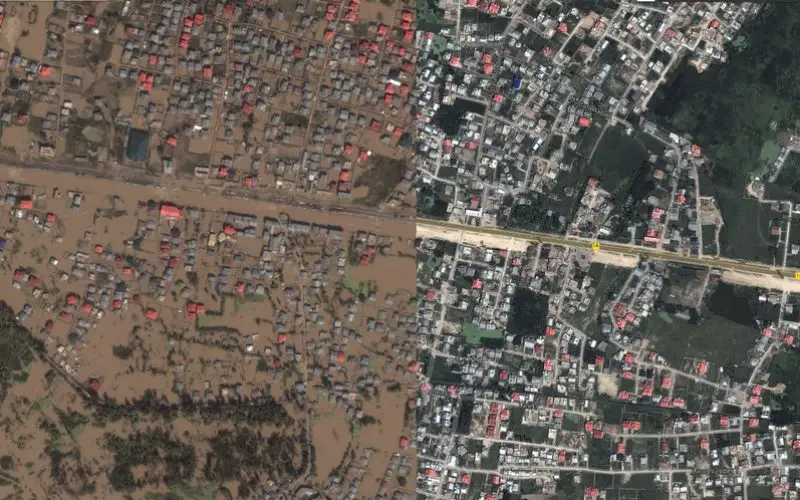
This image from the Jammu and Kashmir Crisis Map shows a before and after cross section from the city of Srinagar Sep. 2014.
Credit: Google India
The first phase of project is being implemented with the help of National Remote Sensing Centre (NRSC), to create map the major river Jhelum (major river in J&K state) and to create the maps of its catchment area.
Later the modeling of other major rivers, Chenab and Tawi will be carried on the same line.
“The digital elevation model will be the first of its kind for the Jhelum, which will help the government make better use of land and save people from floods. There is a need to plug the gaps for future course of action so that we are ready to face such challenges with better preparedness,” said Suresh Chugh, Director, Department of Ecology, Environment and Remote Sensing, Jammu and Kashmir.
– The Tribune