The first-of-its-kind device condenses 3D modeling to one product, one step, in real time
Houston, TX-April 3, 2017 – Kaarta, innovator of the next big leap in 3D modeling, brings an unprecedented combination of ease, usability, speed, and accuracy to the market with the launch of Contour™ – an integrated, handheld device that enables 3D modeling from input to output in real time. Contour condenses the workflow process by eliminating time and cost and allows decision-making at the point of work. First units will ship to select customers in April, with general availability slated for the second half of the year.
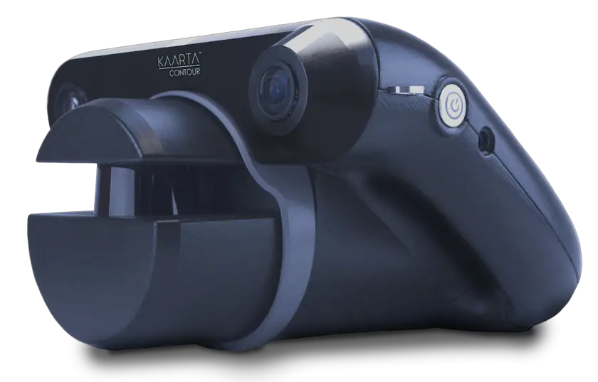
Kaarta Contour front. Image Credit: Kaarta
Contour directly answers unmet challenges in today’s marketplace. Current practices are burdened by multiple products and steps required to collect, process, and finally convert spatial data into an actionable 3D model. Contour merges these discrete tasks into one step, amounting to a simple walk on site with the device in hand. This is made possible by Kaarta Engine, the underlying software which lets the device sense, scan, process, and digitally reproduce its surroundings on the go – an industry first.
Contour’s onboard touchscreen is a major advancement in ease and usability. The screen displays the model as it’s being built in real time, allowing the user to improve results during mapping and even control the display to provide immediate knowledge of the environment. Users are able to pause, rewind, and resume Contour during scanning – a capability only possible due to the ability to view the real-time map.
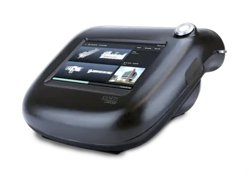
Kaarta Contour back – integrated touchscreen. Image Credit: Kaarta
“While there have been incremental advances in one part of the 3D modeling process or another, we are fundamentally changing the way it’s done by adding ‘robot smarts’ to a new breed of modeling devices,” said Kevin Dowling, CEO of Kaarta. “Scanning alone can take many hours with conventional equipment at a complex site. In contrast, Contour needs just a fraction of that time to complete the entire job; scanning, processing, and producing an accurate 3D model on the fly. We’ve merged the input and output technologies to make 3D modeling easier, faster, and more economical for new and experienced professionals alike.”
Though well suited for numerous industries, Contour will initially target applications in architecture, engineering, and construction, including as-built structures, multi-floor plans, pipelines, industrial plants, and infrastructure for planning and maintenance purposes. The product has already generated favorable reviews from early users, academia, and media outlets including Bloomberg Businessweek.
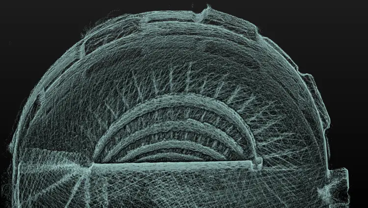
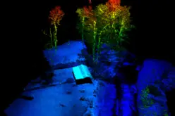
Spiral staircase. Image Credit: Kaarta
“There’s a gap in the marketplace for something that captures 3D, does it quickly, and does it indoors – where there may not be access to prior maps or GPS,” said Aaron Morris, Senior Manager for Reality Solutions at computer-aided design developer Autodesk. He anticipates enthusiastic adoption in the renovation and construction trades, especially as cities across the globe undertake massive efforts to update their aging infrastructure, where “accurate, as-built knowledge is paramount to making sure a project is successful.”
Additional product advantages include:
- Compact, lightweight design for ease of use in any environment
- Integrated lidar, inertial measurement unit (IMU), and high-definition camera
- No dependence on maps, GPS, or other infrastructure
- Lidar accurate to +/- 3 cm
- Integral touchscreen, battery, and sculptured and attractive housing design.
Kaarta will exhibit its product line this week at the SPAR 3D Expo & Conference (booth 310) in Houston, Texas, including live Contour demonstrations, conference panel discussion, and participation in scanning challenges.
Images available upon request.
About Kaarta
Kaarta is the innovator of the next big leap in 3D modeling. Kaarta’s patent-pending technology transforms the real world into highly-accurate, actionable 3D digital models, making real-time decisions possible across a broad range of uses in architecture, engineering, construction, surveying, mining, military, first responder, robotics, and autonomous vehicles. Kaarta models complex environments with unprecedented speed, accuracy and cost efficiency without maps, GPS, or infrastructure. Kaarta is headquartered in Pittsburgh, PA, the hub of robotics innovation. Additional information is available at www.kaarta.com.
Contact
Kevin Dowling, CEO
Kaarta
media@kaarta.com
Kathy Pattison, Head of Marketing
Kaarta
media@kaarta.com