Leica GeoMoS Adjustment v1.7: Adjusted Monitoring Network Data Available Everywhere and Quickly
Leica GeoMoS Adjustment, the network adjustment add-on for the successful Leica GeoMoS monitoring software, is intended for use in projects where the most precise and reliable information on structural movement is required. The latest version now makes adjusted data available everywhere at any time on Leica GeoMoS Web. The computation processing time has also been significantly improved to provide movement analysis with adjusted data as quick as possible.
 At construction sites, tunnels, mines, dams, slopes or wherever the most precise and reliable information on structural movement are needed, Leica GeoMoS Adjustment allows users to make informed decisions based on statistically optimised and validated data.
Making adjusted data available everywhere at any time with GeoMoS Web
GeoMoS Adjustment is able to import acquired monitoring network data with all the necessary parameters. The powerful add-on can compute network adjustments and instantly displays the deformation analysis by epoch, transferring graphical and numerical results to the Leica GeoMoS SQL database. Leica GeoMoS Web now has access to all adjusted coordinates and displacements, allowing users to make their decisions based on adjusted data everywhere at any time.
Obtaining reliable results with significantly faster computation speed
GeoMoS Adjustment allows the combination of measurements from multiple total stations and/or GNSS sensors, which continuously deliver numerous observed points as 3D data. With version 1.7, network adjustment computation speed is now significantly faster. The robust and fast adjustment ensures the very highest precision and reliability.
Providing adjusted data with moving monitoring networks
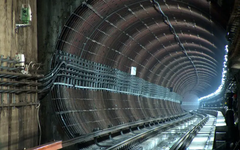
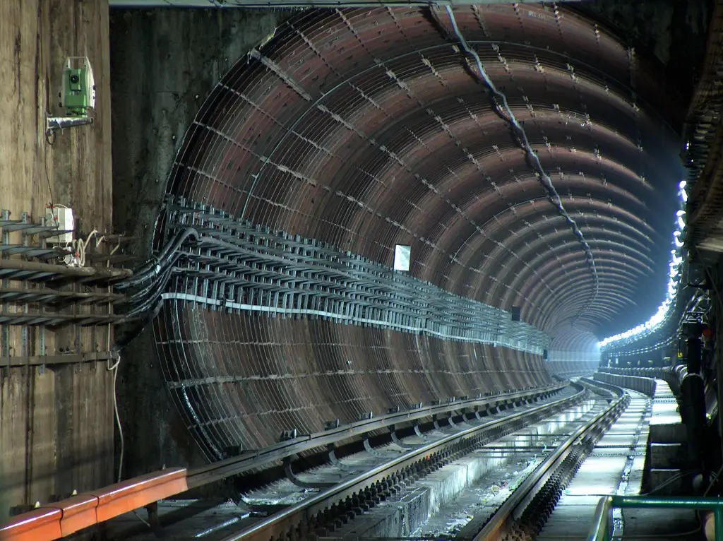
On sites where construction activities are continually moving forward such as in tunnels, the monitoring “network is on the move” as well. During such projects, networks need to be enlarged with additional stable control points, object points and sensors. The new version of GeoMoS Adjustment is now able to automatically detect new points within the network and includes them in the network processing.
Availability
Leica GeoMoS Adjustment v1.7 is immediately available for download at http://www.myworld.leica-geosystems.com/ . For more information on Leica Geosystems Adjustment, please visit: www.leica-geosystems.com/geomosadjustment .
About Leica Geosystems’ Monitoring Solutions
Leica Geosystems’ Monitoring solutions combine geodetic, geotechnical, and meteorological sensors for reliable, precise data acquisition and secure data transmission with advanced processing, sophisticated analysis, and visual representation.
Using standard interfaces, open architectures and scalable platforms, the solutions are customizable to meet individual requirements – for permanent or temporary installations, for single sites or monitoring networks. Modern technology makes installation easy and allows for reliable and state-of-the-art communication via mobile networks.
Leica Geosystems – when it has to be right
With close to 200 years of experience pioneering solutions to measure the world, Leica Geosystems products and services are trusted by professionals worldwide to help them capture, analyze, and present spatial information. Leica Geosystems is best known for its broad array of products that capture accurately, model quickly, analyze easily, and visualize and present spatial information.
Those who use Leica Geosystems products every day trust them for their dependability, the value they deliver, and the superior customer support. Based in Heerbrugg, Switzerland, Leica Geosystems is a global company with tens of thousands of customers supported by more than 3,800 employees in 33 countries and hundreds of partners located in more than 120 countries around the world. Leica Geosystems is part of Hexagon.
Contact:
Agnes Zeiner
Director Marketing Communications
Leica Geosystems AG
CH-9435 Heerbrugg
Switzerland
Tel: +41 71 727 3131
E-Mail: agnes.zeiner@leica-geosystems.com
Source: Lecia Geosystems