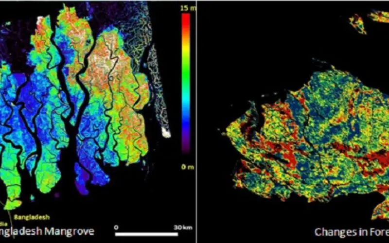
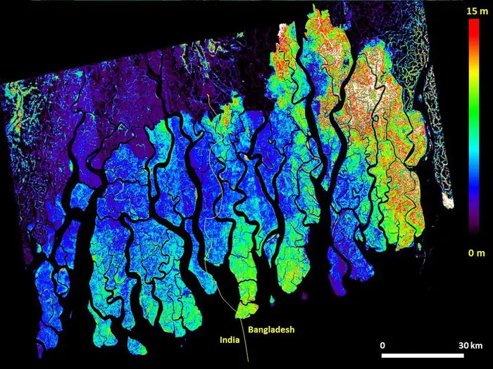
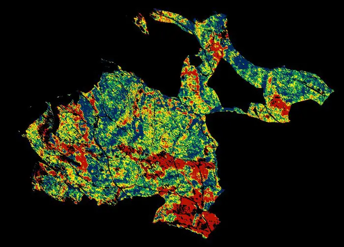
Height of Bangladesh mangrove .
Information on mangrove forest height can be used to estimate biomass, which is extremely important for climate studies and as an energy source in developing countries. The image of mangrove forest in Bangladesh is based on data from the German TanDEM-X satellite and Polarimetric InSAR techniques.
Credit:DLR TanDEM-X data, NASA Goddard Space Flight Center information product
Over the last 10 years a new method using satellite radar data has been maturing to provide 3D views of Earth’s natural resources and urban environments. Scientists from around the world gathered recently to share the latest advances in the exciting technique of ‘POLinSAR’.
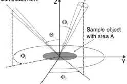
Polarimetric InSAR – or POLinSAR – is a remote sensing technique based on combining polarimetric and interferometric information in synthetic aperture radar images.
With growing interest in the opportunities this remote-sensing technique offers, more than 275 researchers from around the world came together this week at the biennial POLinSAR and first Biomass science workshops hosted at ESA’s centre for Earth observation in Italy.
One of the examples presented at the POLinSAR gathering shows how the height of Bangladeshi mangrove forest, which is an important local resource, can be mapped from space. This example uses data from the German TanDEM-X satellite along with POLinSAR.
The technique of POLinSAR has matured considerably over recent years and scientists are now looking forward to further advances that will come once ESA’s Biomass mission is launched 2020.
Prof. Irene Hajnsek from the German Aerospace Center said, “Ten years ago polarimetry SAR Interferometry was an exotic technique and only few airborne system could provide such data.
“The German TanDEM-X mission has now demonstrated that this novel technique works and we can further look forward to a more sophisticated mode that will be used with ESA’s upcoming Biomass mission.”
This new mission is being designed to provide, for the first time from space, P-band SAR measurements specifically to determine the amount of biomass and carbon stored in forests.
Changes in forest height.
This image of forest in Traustein, Germany, shows how radar can accurately measure changes in forest height over time. Red corresponds to forest parcels where height has been reduced by 5–10 m between 2003 and 2009, possibly owing to logging or storm damage. By contrast, blue corresponds to forest that has grown by 5–10 m over the same time. Green depicts little change.
Credit: DLR HR Microwave and Radar Institute
Prof. Shaun Quegan, the Biomass Principal Investigator from the University of Sheffield, noted, “The unprecedented information on forest biomass, height and biomass change provided by Biomass will revolutionise our understanding of the global carbon cycle as well as providing crucial support for better forest management to mitigate climate change.”
Given the relevance of the Biomass mission, a dedicated workshop was held in parallel with the POLinSAR meeting.
With POLinSAR techniques, a radar instrument sends polarised pulses to Earth and the information in the backscattered signals can be used to infer properties of the target area such as ice and soil moisture.
However, being able to map forest height and structure is one of the main applications using this technique. Using this information, forest biomass can then be estimated.
Together with high-quality ground observations and Earth system models, Biomass mission data will be used to advance our understanding of forest ecosystems and their dynamics and contribute to international initiatives such as the UN Intergovernmental Panel on Climate Change to provide a comprehensive analysis on estimates of terrestrial carbon fluxes for climate change reports.
However, estimates of forest biomass are not only for climate studies, but also for developing countries to assess their energy sources. Once in orbit, the Biomass mission has the potential to contribute to international initiatives such as the REDD+ programme.
Responding to the rapidly growing interest in POLinSAR, the workshop was preceded by an Advanced Course on Radar Polarimetry to help train the next generation of Earth observation scientists to exploit this exciting technique.
Sixty-seven PhD students and post-doc researchers from 27 countries attended this week-long course, which is part of ESA’s Scientific Exploitation of Operational Missions element.