Modeling Aboveground Biomass in Dense Tropical Submontane Rainforest Using Airborne Laser Scanner Data
Modeling Aboveground Biomass in Dense Tropical Submontane Rainforest Using Airborne Laser Scanner Data
– Endre Hofstad Hansen, Terje Gobakken, Ole Martin Bollandsås, Eliakimu Zahabu and Erik Næsset
 Abstract:
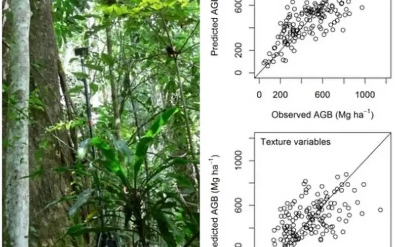
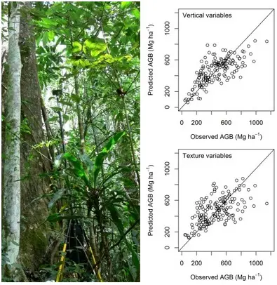
Successful implementation of projects under the REDD+ mechanism, securing payment for storing forest carbon as an ecosystem service, requires quantification of biomass. Airborne laser scanning (ALS) is a relevant technology to enhance estimates of biomass in tropical forests. We present the analysis and results of modeling aboveground biomass (AGB) in a Tanzanian rainforest utilizing data from a small-footprint ALS system and 153 field plots with an area of 0.06–0.12 ha located on a systematic grid. The study area is dominated by steep terrain, a heterogeneous forest structure and large variation in AGB densities with values ranging from 43 to 1147 Mg·ha−1, which goes beyond the range that has been reported in existing literature on biomass modeling with ALS data in the tropics. Root mean square errors from a 10-fold cross-validation of estimated values were about 33% of a mean value of 462 Mg·ha−1. Texture variables derived from a canopy surface model did not result in improved models. Analyses showed that (1) variables derived from echoes in the lower parts of the canopy and (2) canopy density variables explained more of the AGB density than variables representing the height of the canopy.
Keywords: aboveground biomass; airborne laser scanning; canopy surface; LiDAR; texture variables; tropical rainforest
Download Full Paper at: http://www.mdpi.com/2072-4292/7/1/788
Categories:
Research Papers