First-in-the-World: Indonesia is Using Tweets to Map Floods in Jakarta
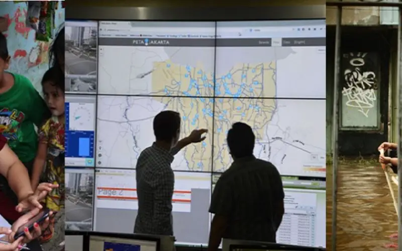

Flood-related Tweets provide real-time disaster response tool in BPBD Jakarta’s incident control room. Courtesy of Tomas Holderness.
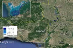
Researchers have taken up the geospatial technology to a new horizon in Indonesia by using tweets from Twitter to map floods in Jakarta. Jakarta suffers from widespread annual flooding during the monsoon season. Because of unpredictable weather patterns, flooding is a serious problem for people living in the Greater Jakarta, the second largest metro in the world.
The project PetaJakarta.org (Map Jakarta) is a pioneering crowd-sourcing data collection project, part of the University of Wollongong, SMART Infrastructure Facility’s continuing research on urban livability, sustainability, and resilience. The research project leverages community participation to report flood- related Tweets and provide real time information updates for faster response times during flooding emergencies.
The project supported by grassroots coalitions between a disaster management agency, University of Wollongong and Tweeter Data Grant to use social data to build a real-time map of areas affected by floods, based on geo-tagged tweets directed to the project using a specific hashtag.
The project runs on the open source software known as CogniCity – GeoSocial Intelligence Framework developed by the SMART Infrastructure Facility. CogniCity harness the power of social media by gathering, sorting and displaying real-time situational reports from urgent urban infrastructure issues such as flooding or traffic congestion.
The CogniCity is based on the three pillars: Collect, Analyse and Communicate. The system collects geo-located/ geo-tagged social media data (users can connect their message to a specific coordinate using mobile phone GPS). When a higher number of similar geo-located points about a specific topic are gathered, then the data is analyse using spatial database technology. The analysis of crowd sourced data helps to visualize patterns on map with complex urban system and can develop predictive tools to ready cities for future disasters and become more resilient in day to day operations.
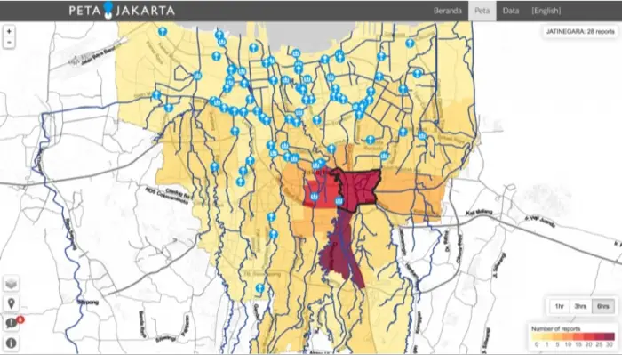
PetaJakarta.org map showing the density of flood-related Tweets in each district. Courtesy of PetaJakarta.org.
In short CogniCity is based on GeoSocial Intelligence Framework which integrates a crowd sourced data and social media data analysis to enable evidence-based, real-time decision making about urban infrastructure. The ability of scalable mapping technology for mobile devices and critical alert service enables the software to disseminate information in real time between individuals and government agencies.
As the pilot study project PetaJakarta.org has radically changed real-time data collection and feedback for flood monitoring in Jakarta city. The project can be implanted to other cities as well and can be expanded to other issues such as traffic congestion, waste management, extreme weather situations etc.
Following are the partner organization in PetaJakarta.org:
SMART Infrastructure Facility, University of Wollongong. SMART- Simulation, Modeling, Ananlysis, Research and Teaching -Australia’s national centre for infrastructure solutions, providing data and analytical capability for the successful creation and execution of a national integrated infrastructure plan.
DKI Jakarta: Daerah Khusus Ibu Kota Jakarta (The Special Capital Region of Jakarta) is the capital and largest city of Indonesia, an emergent global city and one of the most populous urban agglomerations in the world.
BPBD Jakarta: Badan Penanggulangan Bencana Daerah (The Regional Disaster Management Agency) is responsible for the coordination, integration, and synchronization of disaster management systems in Jakarta, Indonesia.
Twitter: is one of the world’s leading social networking platforms and information sharing tools.With 284 million+ active monthly users and 35+ languages supported, Twitter circulates 500 million+ tweets per day. Its pilot project, Twitter Data Grants, allows selected researchers access to Twitter’s public and historical data.
ANDS (Australian National Data Service) is building a cohesive collection of research resources from all research institutions, to make better use of Australia’s research data outputs.
University of Wollongong Global Challenges Program: is a major research initiative designed to harness the expertise of world-class researchers to solve complex, real-world problems—to transform lives and regions.