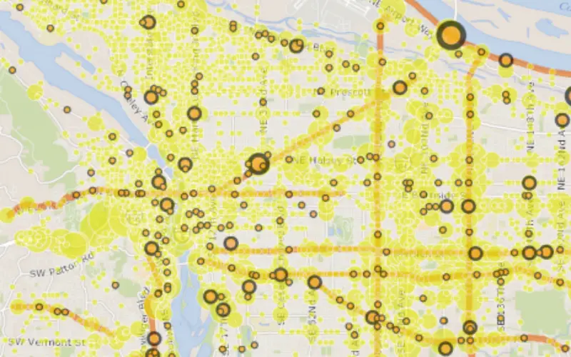
 Various organizations have tried their hand over the years at mapping Portland’s traffic-safety hot spots. Now, the city has created a map of its own. It might be the best one yet.
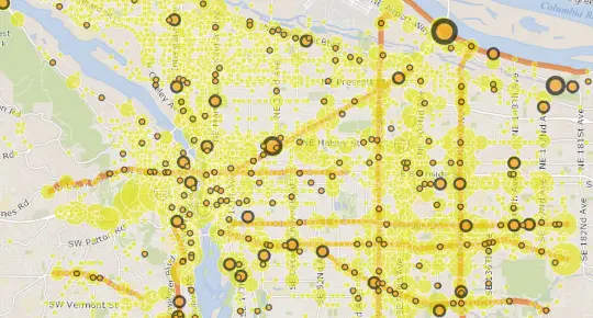
Here’s one thing that sets the city’s map apart: instead of suggesting that road safety is something that matters only to people biking (whose injuries you can see on the map below) it also maps the places where people have been injured while on foot and in cars.
Something else: instead of mapping only fatalities, it also includes all reported injuries, serious and otherwise, from 2004-2013.
This is obviously a very incomplete data set; many hundreds of injuries don’t get reported to any authorities, especially (perhaps) those suffered by people who might want to avoid attracting the law’s attention. It only includes crashes that involve motor vehicles, which means that a collision between a bike and a person, or between a bike and a pole, would not count.
Also omitted: bike crashes involving streetcar tracks. Advocacy group Active Right of Way invites crash reports and sends them to the city, but they’re not recorded here.
If you’re involved in a collision with a car, you can report it by printing out and mailing this form to the Oregon Department of Transportation.
For more information, visit: http://bikeportland.org/2015/04/21/portland-mapped-every-reported-traffic-injury-2004-13-139742