
Tag "China"

China Releases Remote Sensing Data for Environment Protection
BEIJING, June 6 (Xinhua) — China released a remote sensing report on Monday, detailing ecological information related to land cover, vegetation, agricultural conditions and marine environment on a global scale.
Old Map Denies the Philippines’ Claim Over South China Sea
NEW YORK – An old map published in 1899 by geographer J. Martin Miller shows that islands in the South China Sea have never been Philippine territory, Zeng Yingjing, the
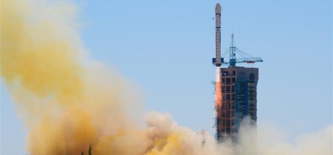
China Launches New High-resolution Satellite for Civilian Mapping
IANS – China on Monday launched a new civilian high-resolution mapping satellite from the Taiyuan Satellite Launch Centre in Shanxi province. The 2.7-tonne Ziyuan III 02 satellite soared on the back
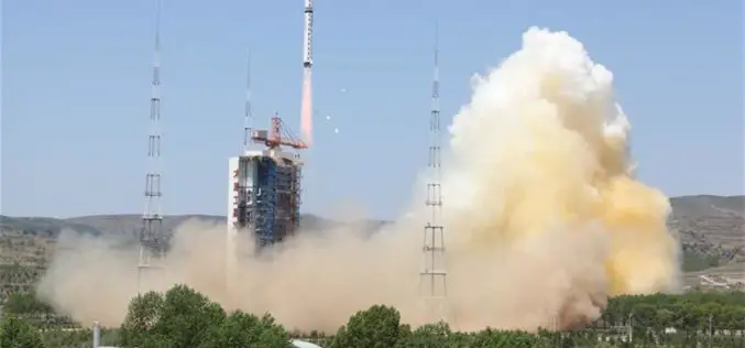
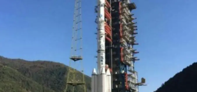
China Launches Yaogan-30 Remote Sensing Satellite
According to recent news by Xinhua, China has successfully launched Yaogan-30 remote sensing satellite into space. The spacecraft lifted off at 10:43 a.m. local time Sunday, May 15 (10:43 p.m. EDT

BRICS Nations to Exchange Remote Sensing Data of the Earth
According to recent news by Sputnik News, The BRICS countries are working to implement an initiative of sharing information on the Earth’s remote sensing, which will allow to swiftly respond to emergency situations and disasters, Russia’s

Pakistan Inked Contract with China to Develop First Remote Sensing Satellite
According to recent news by The Nation, Pakistan Space & Upper Atmosphere Research Commission (SUPARCO) and China Great Wall Industry Cooperation (CGWIC) signed a contract on Wednesday for the development and
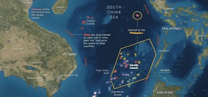
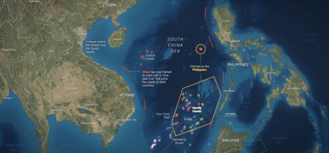
What’s Drives China in the South China Sea? A GEOINT View
Contributed By: The Spratly Islands are a group of more than 750 reefs, islets, atolls, cays and islands in the South China Sea. The history of territorial claim on these

Saudi Arabia to Launch Remote Sensing Satellite from China
Riyadh — King Abdulaziz City for Science and Technology (KACST) is working to complete preparation of the components of the Saudi satellite (Saudi SAT 5B) which is locally made, in
China Launches Gaofen-4 Remote Sensing
The Chinese have closed out the year with the launch of Gaofen-4 Remote Sensing from Long March 3B/G2 rocket. The launch involved the orbiting of a geostationary remote sensing bird,

China Plans to Build Remote Sensing Satellite Network with Global Coverage
China is planning to build a remote sensing satellite network with global coverage by setting up more ground stations overseas. The move will enable China to provide diversified data to foreign
