
Tag "Cloud"

Seequent Accelerates Cloud-Based Solution to Help Keep World at Work on Major Projects
High-growth geoscience software company Seequent is accelerating the development of its cloud-based solution Seequent Central, enabling organisations to continue work on critical, large-scale, earth, environment and renewable energy projects in

Top 5 GIS Trends for 2018
Contributed By: You’re reading this because seamlessly integrating Geographical Information Systems (GIS) into your company’s IT infrastructure including SAP is crucial. Challenges you’re grappling with probably include absorbing tech upgrades

Pix4D Partners with Kokusai Kogyo in Japan to Deliver a 3D Geospatial Analysis Cloud Service
Full automation for 3D spatial analysis that support i-Construction and public surveying November 20, 2017 – Pix4D is partnering with Kokusai Kogyo Corporation (KKC)—the leading geospatial consulting company in Japan–to deliver
Esri Offers Customers On-Demand Deployment and Managed Services in the Cloud
November 30, 2016 – Redlands, California—At this year’s AWS re:Invent, global smart-mapping leader Esri announced that customers can now deploy select ArcGIS licenses from Amazon Web Services (AWS) Marketplace instantly, using

SimActive Enables Processing in the Cloud
November 29, 2016 – SimActive Inc., a world-leading developer of photogrammetry software, is pleased to announce that processing in the cloud is now officially supported by Correlator3D™. Users can subscribe to

Esri and NASA Collaborate to Advance Cloud Access to Imagery
Esri Opens LERC to the Geospatial Community Redlands, California—Esri and NASA are collaborating to improve access to imagery and raster data stored in the cloud using a combination of two
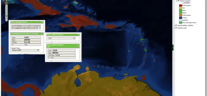
SuperGIS Server Extends Map Possibilities with Various Resources
This week, Supergeo releases the latest version of SuperGIS Server with plenty of new functions, including related tables, improved JavaScript print tool, and new JavaScript APIs supporting OGC layers. With

Insights to SuperGIS Server 10
Supergeo is going to upgrade all the products to a new level, the 10 series, including SuperGIS Server. The most exciting thing in SuperGIS Server 10 is its integration of
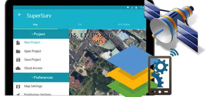
Behold! SuperSurv 10 Come for Unleashing the Power of Latest Technology in Mobile GIS
Can’t find the best fit mobile GIS solution for your field work? Wondering with all the hardcore and complicated operations in most survey Apps? Get ready to experience the brand
