
Tag "Drought"
GIS Resources Magazine (Issue 3 | September 2019): The Role of Geospatial Technologies in Drought Monitoring and Mitigation
GIS Resources Magazine (Issue 3 | September 2019) – The Role of Geospatial Technologies in Drought Monitoring & Mitigation GIS Resources is pleased to announce the release of its 3rd edition (September 2019) of the print and digital magazine. The
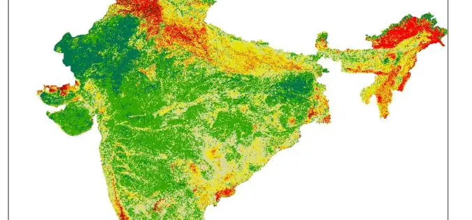
Pan India Drought : A Near Reality – An Analytical Story
Contributed By: This analytical story is about Drought, its frequency and intensity across India. This story emerged while working on Drought Vulnerability Management System. This story is due to effort put
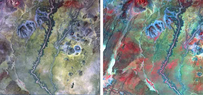
NAU Scientist Uses Remote Sensing to Detect Groundwater in Drought-stricken East Africa
Drought is a condition when a region notes a deficiency in its water supply whether surface or underground water. A drought can last for months or years, or may be declared
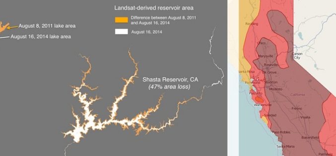
Drought Monitoring and Visualization with Open Data
Drought is condition when a region notes a deficiency in its water supply whether surface or underground water. A drought can last for months or years, or may be declared after
