
Tag "Elevation Model"
Business
Software
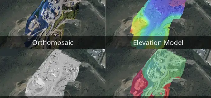
3 New Elevation Viewers, Now in Site Scan
August 9, 2017 – One of the most common uses for Site Scan is performing topographic surveys: you can use a drone to survey your site faster, safer, and more cost-effectively,
Remote Sensing
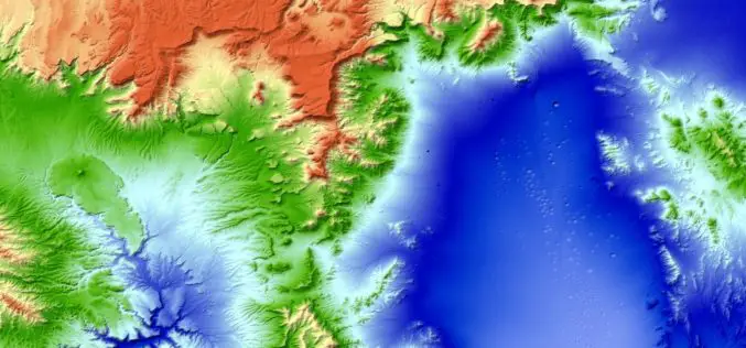
New 3D World Map – TanDEM-X Global Elevation Model Completed
The new three-dimensional map of Earth has been completed. Mountain peaks and valley floors across the globe can now be seen with an accuracy of just one metre. The global

Business
Vricon Introduces Groundbreaking Medium-resolution Digital Surface Model
November 10, 2015 – Vricon releases a medium-resolution global digital surface model (DSM) for $1.99 per km2 that defines a new industry standard for this product class. Vricon DSM-10 is
