
Tag "Geographic Information System"

GIS Partnership to Aid Removal of Land Mines
Geneva International Centre for Humanitarian Demining to Employ Latest Esri Mapping Technology in Worldwide Efforts Redlands, California—Esri and the Geneva International Centre for Humanitarian Demining (GICHD) signed a memorandum of
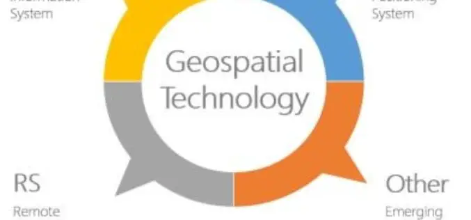
Geospatial Technologies Picking Up Greater Momentum
With the advancement in Remote Sensing and development in Geographic Information System and Global Positioning System, the applications of Geospatial Technologies in various fields have picked up greater momentum, a

Bring Spatial Skills to Canadian Children, Become a GIS Ambassador
Geospatial professionals, educators & students encouraged to help youth develop problem-solving skills using technology Spatial thinking involves understanding the relationships between objects based on their location and learning the importance
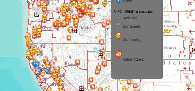
Interactive Tool to Access and Track Live, Wildfire Information
Free, Public Tool Consolidates Information to Provide Up-to-Date Disaster Snapshot WASHINGTON, D.C., Thursday, Sept. 17, 2015 — The American Red Cross has launched an interactive online map that consolidates multiple

Esri Publishes Getting to Know ArcGIS, Fourth Edition
Use the Workbook and Exercises to Get Started Making Maps and Analyzing Data Learn the fundamentals of making digital maps, analyzing geospatial data, and building and editing spatial databases using

New State Map from Indiana Geological Survey Makes Use of High-Res Imaging
BLOOMINGTON, Ind. — The Indiana Geological Survey has published a new state map that features the latest digital technology using high-resolution elevation data. The map was prepared using lidar data
Better Business Decisions with Esri’s Up-to-Date Data and Reports
Redlands, California—Having up-to-date information is crucial for accurate decision making in business. Esri’s ArcGIS platform provides access to updated demographics, Tapestry Segmentation, Retail MarketPlace, consumer spending, marketing potential, and traffic

Changing Hands at Cadcorp
The leadership team at GIS software vendor Cadcorp has successfully completed a management buyout (MBO) of the company. The MBO secures the business’ future as one of the UK’s leading
Mapmakers Invited to Submit Best of the Best – Esri’s Storytelling with Maps Contest
Esri Launches Worldwide Storytelling with Maps Contest Redlands, California—Mappers everywhere who harness the power of geographic information system (GIS) technology to tell their stories can now enter Esri’s Storytelling with

Esri Launches New Site to Find Open Data
Search and Discover Authoritative Information from Any ArcGIS Open Data Website Redlands, California—Esri today announced the launch of a new site aimed to help citizens discover organizations sharing open data
