
Tag "Hyperspectral"
LiDAR and Hyperspectral Data Fusion
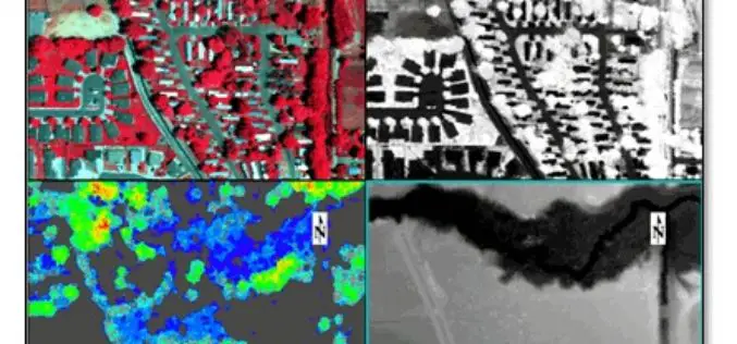
We all in the geospatial domain have heard about data fusion/image fusion, a technique or way of combining the spectral information of a coarse-resolution image with the spatial resolution of

PhD Studentship in Hyperspectral Remote Sensing
Cranfield University is a British postgraduate and research-based university specialising in science, engineering, technology and management. It contains two campuses; the main campus is at Cranfield, Bedfordshire, and the second is the
5th EnMAP School on Hyperspectral Remote Sensing
The EnMAP Science Advisory Group (EnSAG) organizes the 5th EnMAP School at Trier University in April 2016. We are pleased to host the EnMAP School in Trier for the second

Indian Student Bags Germany’s Green Talents Award
Arun Prasad Kumar, a Ph.D. scholar from Indian Institute of Space Science and Technology (IIST) has bag a Germany ‘Green Talents Award’ at the 7th Green Talents 2015. He is the

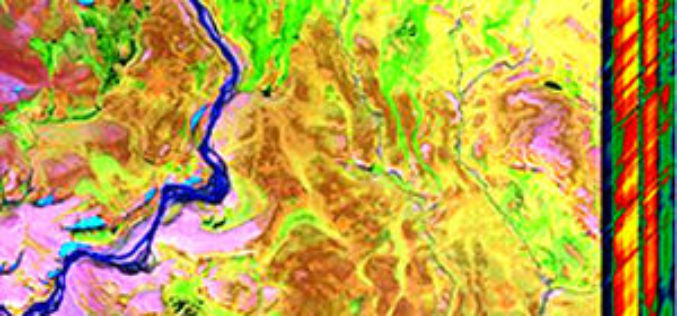
Hyperspectral Remote Sensing Reveals New Blind Geothermal System
Identification of a new blind geothermal system with hyperspectral remote sensing and shallow temperature measurements at Columbus Salt Marsh, Esmeralda County, Nevada Hyperspectral remote sensing-derived mineral maps and follow-up shallow
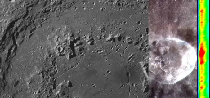
Opportunity for Utilizing Chandrayaan-1 Data from Terrain Mapping Camera and Hyperspectral Imager
Space Applications Centre (SAC), Indian Space Research Organisation (ISRO), Department of Space (DOS), Government of India, declares an “Announcement of Opportunity (AO)” to carry out scientific research by utilisation of
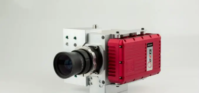
Specim, A Global Leader In Hyperspectral Imaging, Granted 5.3 M€ Growth Financing
/INS. SPECIM, Spectral Imaging Oy Ltd., a pioneer and global leader in hyperspectral imaging instruments and systems, has received 5,3 M€ of financing to ensure its growth. The financing package
Geo-matching.com Adds Thermal, Multi- and Hyperspectral Imaging
Geo-matching.com has recently added thermal, multi- and hyperspectral imaging to its broad spectrum of product categories. Teledyne Optech is the first supplier in this category with the CS-MS 1920. In addition
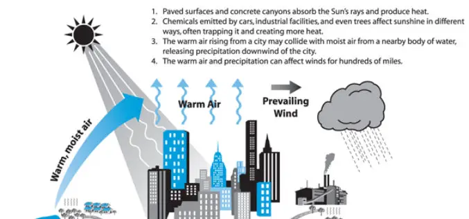
Analysis of the Urban Heat Island Effect in Shijiazhuang, China Using Satellite and Airborne Data
Analysis of the Urban Heat Island Effect in Shijiazhuang, China Using Satellite and Airborne Data – Kai Liu, Hongbo Su, Lifu Zhang, Hang Yang, Renhua Zhang and Xueke Li Abstract: The urban heat island (UHI)
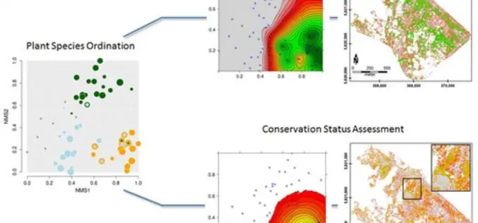
Gradient-Based Assessment of Habitat Quality for Spectral Ecosystem Monitoring
Gradient-Based Assessment of Habitat Quality for Spectral Ecosystem Monitoring – Carsten Neumann , Gabriele Weiss, Sebastian Schmidtlein, Sibylle Itzerott, Angela Lausch, Daniel Doktor, and Maximilian Brell Abstract: The monitoring of ecosystems alterations has become a crucial
