
Tag "landslide"
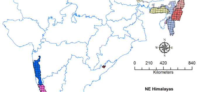
Geological Survey of India to Complete Landslide Susceptibility Mapping in 2018
Kolkata, December 6, 2017 (IANS) : The Geological Survey of India (GSI) is set to complete generation of Landslide Susceptibility Maps – covering an area of 1.71 lakh sq km
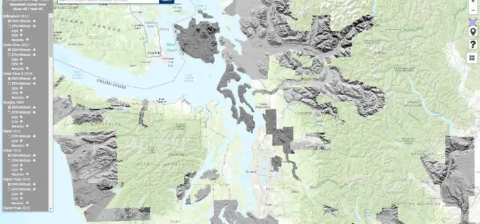
Washington State Department of Natural Resources Published New Landslide Mapping Standards Using LiDAR
Protocol standardizes methods for using LiDAR to map landslides in Washington State The Washington State Department of Natural Resources (DNR) has published standardized methods for mapping landslides in Washington using
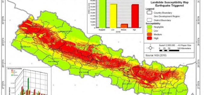
Nepal: Pilot Project on Landslide Hazard Mapping
Kathmandu – According to recent news by The Himalayan Times, the Department of Soil Conservation and Watershed Management, Nepal has started a pilot project of landslide hazard mapping from Dolakha
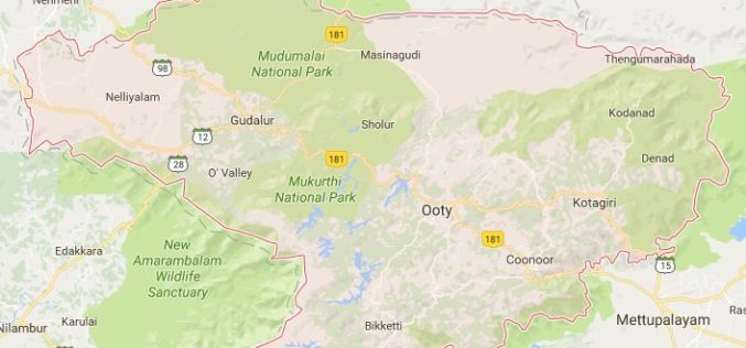
Geological Survey of India to Map Landslide-prone Zones in Nilgiris
According to recent news by TOI, almost three years back the Geological Survey of India (GSI) has started the process of mapping landslide-prone zones in the Nilgiris (Western Ghats of India),

RIEGL with Broad and Impressive Product Range, New Products at Intergeo 2016
RIEGL uses the INTERGEO platform traditionally to give an insight and an overview on its comprehensive LiDAR sensors and systems product range. At booth C3.059 in hall A3, on the

NDMA Holds Meeting on Landslide Risk Management Strategy
ANI – The National Disaster Management Authority (NDMA) today called on a meeting to discuss the formulation of a National Landslide Risk Management Strategy. This was the first meeting of
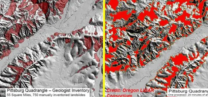
Contour Connection Method: an automated Method for Landslide Identification with LiDAR
In a study by Ben A. Leshchinsky et. al., from Oregon State University has developed a new algorithm “Contour Connection Method” for automated landslide deposits from LiDAR data. Landslide is

Mapping Switzerland’s Danger Spots
A Landslide In Southern Switzerland Has Left Two Dead. The Area Hadn’t Been Included In National Danger Zone Maps. A wall above the property apparently collapsed after days of heavy
