
Tag "LiDAR"

GIS Resources Magazine (Issue 2 | June 2022): LiDAR For Real-World 3D Modelling Applications
GIS Resources is pleased to announce the publication of its 2nd edition (June 2022) of the print and digital magazine. The edition titled “LiDAR For Real-World 3D Modelling Applications.” The LiDAR

RIEGL VZ-i Line Scanners for Permanent Monitoring Applications and Integration Capabilities into Customers Risk Management
In the context of climate change and the expansion of areas of urban settlement, e.g., in Alpine regions, the demand for high-quality datasets as well as the integration into risk
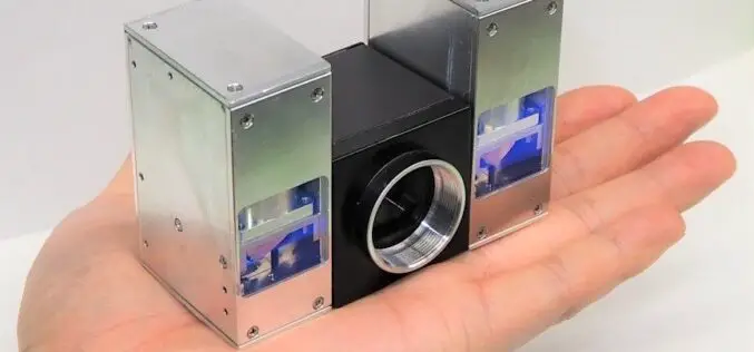
Toshiba Palm-sized LiDAR with a Range of 300m
Toshiba recently announced significant progress in downsizing the laser projector portion of their LiDAR to one-quarter the size of the previous iteration, which was introduced in June 2021. Using two
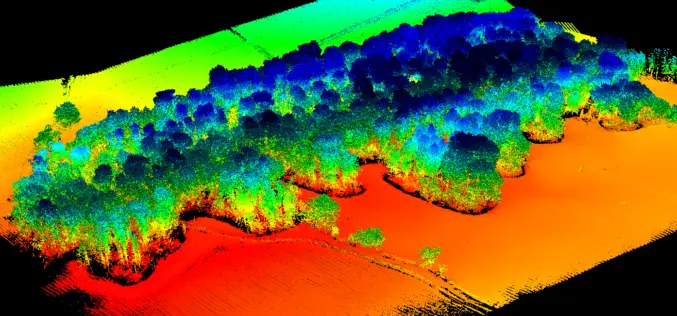
UAV LiDAR Technology in Forest Management
This case study from Routescene demonstrates the value of UAV LiDAR derived point cloud data for operational forest management.

LiDAR for Water and Soil Conservation in Forests
The Odisha state government is using LiDAR technology for the first time to implement soil and water conservation projects in forest areas. The initiative aims to increase groundwater recharge by
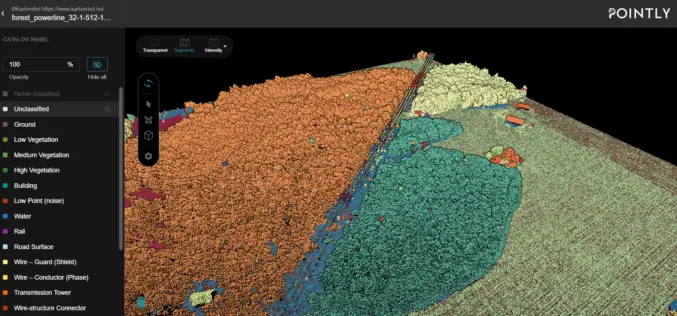
Automated Point Cloud Analysis for Forestry Mapping
Pointly has developed AI solution, that takes point clouds as input and outputs a shapefile with the location of tress for forestry mapping.

GIS Resources Magazine (Issue 4 | December 2021): LiDAR Technology in Forestry Mapping
GIS Resources is pleased to announce the publication of its 4th edition (December 2021) of the print and digital magazine. The edition titled “LiDAR Technology in Forestry Mapping.” Geospatial technology incorporates

RIEGL Presents New Products at INTERGEO 2021
INTERGEO is back LIVE in Hanover this year – and RIEGL presents the latest developments in hardware and software at booth 20C.22 in hall 20 but also digital at the
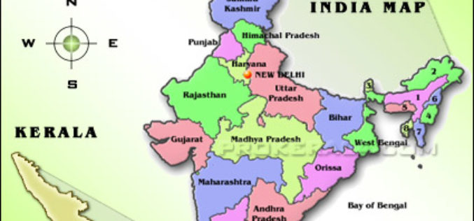
CORS Network to Complete Digital Land Resurvey in Kerala
Kerala State Government has given a nod to extended Digital Land Resurvey for 1,550 villages at cost of ₹807.98-crore. The project is expected to complete the resurvey of land over

NV5 Geospatial Expands Mobile Mapping Fleet with State-of-the-Art RIEGL VMX-2HA Platform
RIEGL today announced that NV5 Geospatial, North America’s largest geospatial data firm, has acquired the new RIEGL VMX-2HA dual scanner mobile mapping system. The solution will initially deploy in utility
