
Tag "Machine Learning"
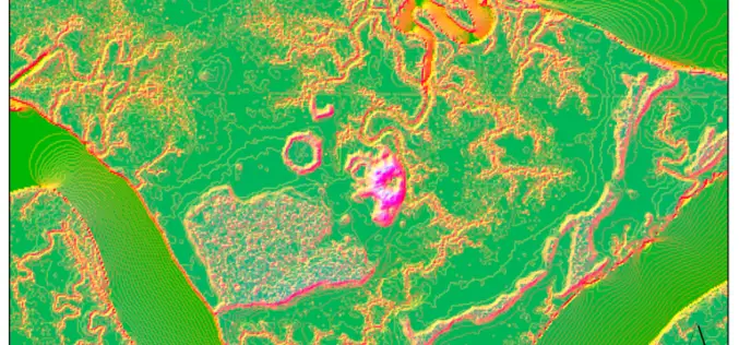
Machine Learning to Discover Shell Rings Using Remote Sensing Data
Deep in the dense coastal forests and marshes of the American Southeast lie shell rings and shell mounds left by Indigenous people 3,000 to 5,000 years ago. Now an international

NIT Karnataka is Offering Free Course on Machine and Deep Learning for Remote Sensing Applications
NIT Karnataka is Offering is offering two weeks online summer school on Machine and Deep Learning for Remote Sensing Applications.

How MIT using LiDAR and ML for More Efficient Self-driving Car?
A LiDAR (Light Detection and Ranging) system beams light out and then precisely monitors the timing of reflections to map and track objects within its detection range. A LiDAR instrument principally

UP42 Webinar on Fusion of Satellite Imagery, AIS Data, Machine Learning for Maritime Surveillance
UP42, creator of the leading developer platform for Earth observation data and analytics, will host a free webinar on maritime monitoring and surveillance on Dec. 9, 2020. Presentations will discuss
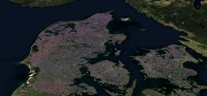
Machine Learning Helps SEGES to Detect 26K Slurry Tanks over Denmark to Assess Ammonia Emission
The article talks about How SEGES detected 26000 slurry tanks over Denmark in a few hours using Picterra to assess ammonia emission.
Join MAXAR to Learn How Satellite Data is used by Organizations in Responding to Business Disruption and Emerging from Lockdown
Join MAXAR to Learn How Satellite Data is used by Organizations in Responding to Business Disruption and Emerging from Lockdown

Microsoft India Using Artificial Intelligence to Help Indian Farmers
New Delhi: New technologies such as Artificial Intelligence (AI), Cloud Machine Learning, Satellite Imagery and advanced analytics are empowering small-holder farmers in India to increase their income through higher crop
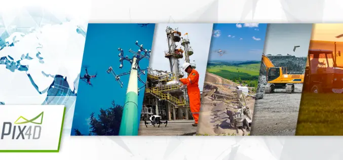
Pix4D is Expanding Globally
Capturing a billion dollar market with advanced computer vision, machine learning, and photogrammetry December 07, 2017 – Pix4D is adding two senior executives to our leadership team to strengthen our global
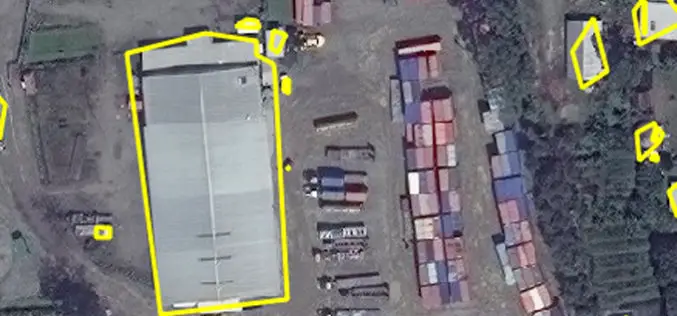
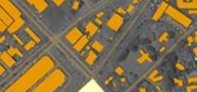
East View Geospatial Enhances Training Data Accuracy for Automated Feature Identification in Machine Learning Trials
MINNETONKA, Minnesota, USA, 1 June 2017 – East View Geospatial (EVG), a provider of content-rich cartographic products, continues to enhance the accuracy of automated feature identification using its newly developed
East View Geospatial Announces Training Data Library for Geospatial Machine Learning
MINNETONKA, Minnesota, USA, 24 April 2017 – East View Geospatial (EVG), a provider of content-rich cartographic products, is building a library of highly accurate geospatial training data for use in
