
Tag "National Geospatial-Intelligence Agency"

National Geospatial-Intelligence Agency Seeks Algorithm for Automatically Image Colorization
SPRINGFIELD, Virginia, July 11, 2018 — The National Geospatial-Intelligence Agency is seeking an algorithm that can rapidly, accurately and automatically colorize large panchromatic images of up to 10 gigapixels in
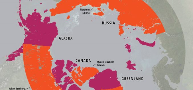
ArcticDEM Project Has Now Mapped More Than 65 Percent of The Arctic
ArcticDEM Release 5 represents the largest release of elevation data to date, more than doubling the number of available strip DEMs, mosaic tiles and geographic coverage area of all releases
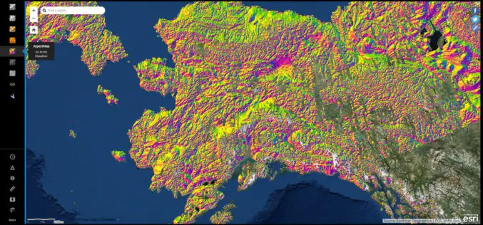
NGA Releases Biggest Collection of Arctic Elevation Data Yet at Esri FedGIS Conference
ArcticDEM Provides High-Quality Elevation Data and Enables Communities to Take Action Redlands, California—Esri, the global leader in spatial analytics, together with the ArcticDEM project—a public-private initiative to produce high-resolution, high-quality

India to Ink Agreements With US on Sharing Geospatial Information and Data
According to recent news published by The Indian Express, following the inking of an important logistical pact (LEMOA) with the US, Defence Minister Manohar Parrikar has indicated that India is

Create, Share Geotagged, Media-rich Field Reports With New NGA Mobile App
The National Geospatial-Intelligence Agency’s latest publicly available mobile app is now available on iTunes and Google Play. The Mobile Awareness GEOINT Environment, MAGE, was developed to support first responders deploying
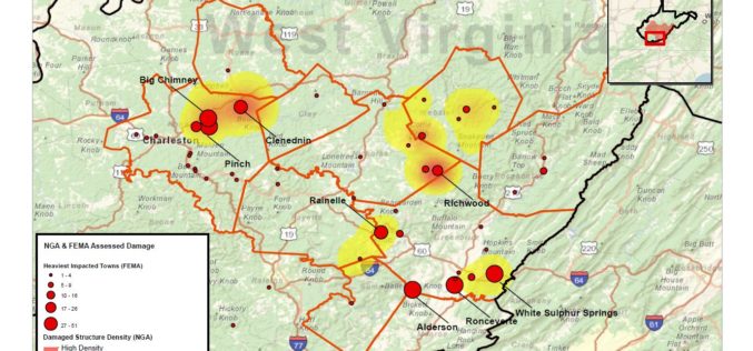
National Geospatial-Intelligence Agency Provides Expertise Response to West Virginia Flooding
As reported in a recent news bulletin by The National Geospatial-Intelligence Agency (NGA), NGA is providing geospatial expertise and damage assessments to the Federal Emergency Management Agency (FEMA) for flooded

New NGA Global Map Advances R&D in Geophysics and Nonproliferation
The map uses open-source geophysical data sets and publicly available international antineutrino detection observational data to depict varying levels of radioactivity on Earth. A team of researchers led by scientists

Geospatial Innovation in Spotlight at Esri Conference in DC
NGA Director Robert Cardillo and Former Maryland Governor Martin O’Malley to Keynote Redlands, California—Technology and government leaders will gather for the Esri Federal GIS Conference in Washington, DC, February 9–10,
NGA Announces CIA Veteran as Deputy Director
SPRINGFIELD, Virginia — The National Geospatial-Intelligence Agency announced today that Susan M. Gordon, a 34-year veteran of the intelligence community, will become deputy director upon the retirement of Mike Rodrigue,
