
Tag "point cloud"
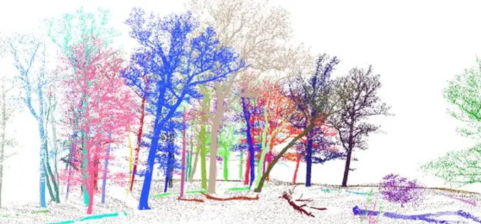
3D Forest – Forest LiDAR Data Processing Tool
Tool for point cloud data processing from forest environment acquired by terrestrial laser scanner (TLS) 3D Forest is an open-source software application for LiDAR data segmentation, visualization, and export of
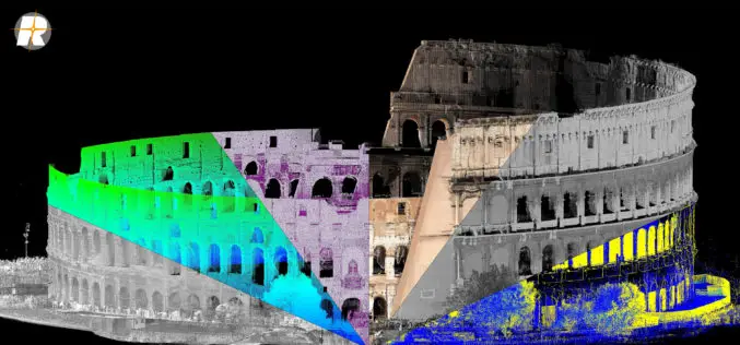
Major Update of RIEGL’s Terrestrial Laser Scanning Software Suite Now Available!
RIEGL is pleased to announce the release of a major update to their Terrestrial Laser Scanning Software Suite of RiSCAN PRO, RiMINING and RiSOLVE! The latest terrestrial laser scanning software
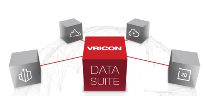
Vricon Data Suite: Putting Earth in Customers’ Hands
7 January 2016 — Today, Vricon unveils its Data Suite that includes the Vricon 3D Surface Model, Vricon DSM, Vricon Point Cloud, and Vricon True Ortho. All four products are

MicroSurvey CAD 2016 Now Available
A high-performance engine and intuitive new point cloud tools enable land surveyors and civil engineers to work faster and smarter. West Kelowna, BC, Canada – December 1, 2015 – MicroSurvey
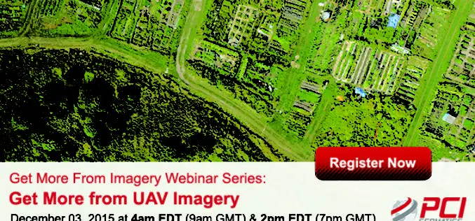
Webinar Series: Get More from UAV Imagery
Get More From Imagery Webinar Series: Get More from UAV Imagery Dec. 03, 2015 at 4am EDT (9am GMT) | Dec. 03, 2015 at 2pm EDT (7pm GMT) PCI Geomatics is the
LiDAR, Point Cloud and SuperGIS Desktop 10
Have you ever thought of using LiDAR data through geographic information system to improve field tasks such as Forestry Management, Disaster Prevention, Coastal Change Management, and Contamination Simulation and so
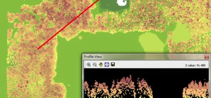
LAStools Toolbox now also for ERDAS IMAGINE 2015
The August release of LAStools from rapidlasso GmbH now also contains a toolbox for the latest 15.1 version of ERDAS IMAGINE® 2015 from Hexagon Geospatial. The two companies had announced their cooperation earlier this year after releasing
Telangana Government to Take Up LiDAR Survey of Barrages and Canals
As reported in The New Indian Express, the Telangana Government is all set to start the LiDAR survey of the altered Pranahita – Chevella project from August 18. The state government
Implementing LiDAR Technology in Transportation System
Brian Davis a Research Fellow at University of Minnesota is working on LiDAR (light detection and ranging) technology for implementing in transportation systems. Davis and his fellow researchers have outfitted a
LizardTech Launches GeoExpress 9.5
LizardTech, a provider of software solutions for managing and distributing geospatial content, announced the launch of GeoExpress 9.5 at this week’s Esri International User Conference, California. GeoExpress enables geospatial professionals to
