
Tag "WorldDEM"

GIS Data
Airbus and CSTARS Provide “WorldDEM Ocean Shoreline” for Uniquely Accurate Coastline Mapping
Homogeneous, gap-free and single source vector product delineates world’s ocean shorelines detailed and up-to-date Friedrichshafen, 29 May 2017 – Airbus Defence and Space expands its WorldDEM portfolio with the launch
GIS
GIS Data
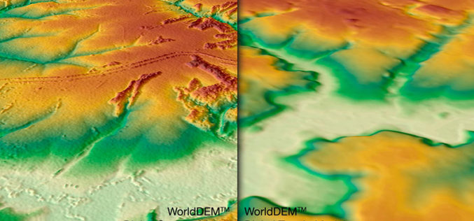
WorldDEM DTM Now Available
Precise Terrain Information Globally for Effective Analysis The WorldDEM Digital Terrain Model (DTM) is now commercially available for all users that need superior terrain information anywhere on the globe. The
GIS
Remote Sensing
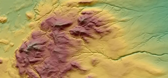
Reach More Accurate Heights with WorldDEM™ dataset
The WorldDEM™ from Astrium is Intended to be the Replacement Data Set for SRTM Here it comes the most accurate DEM after a long overdue treat. The WorldDEM™ data from Astrium is a
