Launch of Bhuvan Panchayat (v4.0) & National Database for Emergency Management (v5.0)
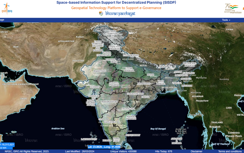
On June 28, 2024, Union Minister Dr. Jitendra Singh unveiled two significant geoportals: Bhuvan Panchayat (Version 4.0) and the National Database for Emergency Management (NDEM Version 5.0). These advancements, launched under the aegis of the Indian Space Research Organisation (ISRO), mark a substantial leap in India’s commitment to leveraging geospatial technology for better governance, disaster management, and rural development.
Bhuvan Panchayat (Ver. 4.0)
What is Bhuvan Panchayat?
Bhuvan Panchayat is a geoportal developed by ISRO aimed at enhancing the planning and monitoring of various developmental activities at the Panchayat level. The latest version, 4.0, brings more sophisticated features and improved usability to support rural development projects.
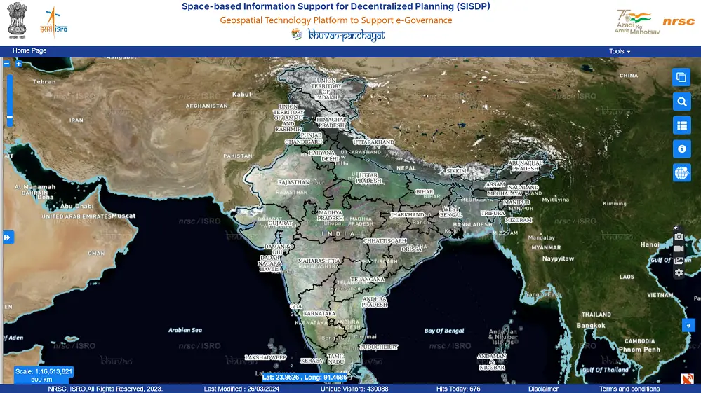
The current version of the Bhuvan Panchayat Geoportal (Ver. 4.0) is an online platform designed to disseminate geospatial data and services. This platform, available at Bhuvan Panchayat, facilitates the integration and utilization of space-based information for governance and research initiatives, focusing on spatial planning at the Gram Panchayat level. Developed by the National Remote Sensing Centre (NRSC) of ISRO, the WebGIS platform enables visualization, analysis, and sharing of Web Map Service (WMS) data products generated at a 1:10,000 scale under the Space-based Information Support for Decentralized Planning (SISDP) project. The platform employs state-of-the-art web technologies to ensure cross-platform and device interoperability, offering an optimal user interface and user experience (UI/UX) for diverse user sectors.
Importance of Bhuvan Panchayat
- Empowerment of Local Governance: Bhuvan Panchayat empowers local governing bodies by providing detailed geospatial data. This aids in informed decision-making, ensuring that developmental activities are aligned with the needs of the community.
- Enhanced Transparency and Accountability: With access to real-time data and analytics, the platform promotes transparency and accountability in the execution of rural projects. This helps in the effective utilization of resources and curbing corruption.
- Holistic Development Planning: The platform provides comprehensive data that supports integrated planning for various sectors such as agriculture, water resources, infrastructure, and social services. This holistic approach ensures balanced and sustainable rural development.
- Citizen Participation: By making data accessible to the public, Bhuvan Panchayat encourages citizen participation in governance. This inclusivity ensures that development is people-centric and addresses the actual needs of the rural populace.
National Database for Emergency Management (NDEM Ver. 5.0)
What is NDEM?
The National Database for Emergency Management (NDEM) is a critical initiative by ISRO designed to provide geospatial data and decision support tools for disaster management. Version 5.0 of NDEM introduces advanced capabilities to enhance India’s disaster preparedness and response mechanisms.
NDEM provides a comprehensive, uniform, structured, multi-scale geospatial database for the entire country, facilitating situational assessment and effective decision-making during disasters or emergency situations. As a national-level geoportal, NDEM amalgamates space-based information with Decision Support System (DSS) tools and services from disaster forecasting organizations, addressing all natural disasters across all phases for effective Disaster Risk Reduction (DRR) in the country. Additionally, NDEM functions as a Disaster Recovery and Data Provider node for the Integrated Control Room for Emergency Response (ICR-ER) being established by the Ministry of Home Affairs (MHA) in New Delhi.
Importance of NDEM
- Comprehensive Disaster Management: NDEM offers a robust platform for managing all phases of disaster management – from preparedness and mitigation to response and recovery. This comprehensive approach ensures minimal loss of life and property during disasters.
- Real-time Data and Analytics: The portal provides real-time data and predictive analytics, which are crucial for timely decision-making during emergencies. This helps in deploying resources effectively and mitigating the impact of disasters.
- Coordination Among Agencies: NDEM facilitates seamless coordination among various government and non-government agencies involved in disaster management. This collaborative approach enhances the efficiency of disaster response operations.
- Community Resilience: By providing accurate and timely information, NDEM helps build community resilience. Educating communities about potential risks and preparedness measures ensures they are better equipped to handle emergencies.
Background and Development
Bhuvan Panchayat
Bhuvan Panchayat was initially launched as part of the Bhuvan platform, an ambitious project by ISRO to create a comprehensive geoportal for Indian users. The platform was envisioned to offer satellite imagery, thematic maps, and geospatial tools for a variety of applications. Over the years, Bhuvan Panchayat has evolved to become a vital tool for rural development, supporting numerous government schemes such as the Mahatma Gandhi National Rural Employment Guarantee Act (MGNREGA) and Pradhan Mantri Awas Yojana (PMAY).
NDEM
The NDEM initiative was conceptualized following the recognition of the critical role geospatial data plays in disaster management. India’s vulnerability to a wide range of natural disasters necessitated the creation of a centralized platform that could provide timely and accurate information. Over the years, NDEM has undergone several upgrades to incorporate the latest technological advancements, ensuring it remains at the forefront of disaster management efforts.
Conclusion
The launch of Bhuvan Panchayat (Ver. 4.0) and NDEM (Ver. 5.0) underscores the Indian government’s commitment to utilizing cutting-edge technology for governance and disaster management. These geoportals are not just technological advancements; they represent a vision of a more transparent, accountable, and resilient India. As these platforms continue to evolve, they promise to play a pivotal role in shaping the future of rural development and disaster management in the country.





Quality articles or rеviews is the key tο attract the
visitors to pay a quick visit the sіte, that’s what this web
site iѕs providing.