
Tag "Bluesky"
Bluesky Aerial Photomaps Help Outfield Reveal Secrets to Improving Farm Management
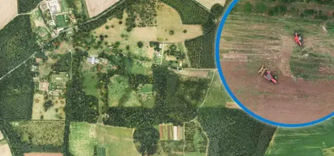
December 4, 2018 – Ultra high-resolution aerial photography and 3D landscape models from Bluesky are helping Outfield Technologies develop innovative image recognition techniques to improve agricultural land management and crop
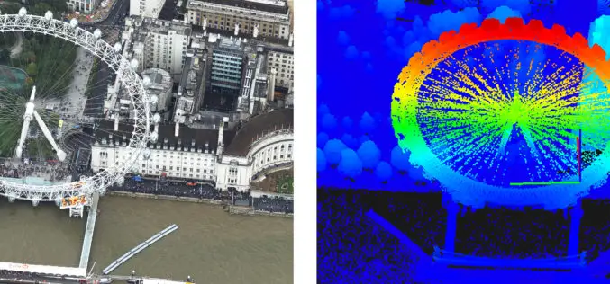
Bluesky uses Leica CityMapper to capture major UK cities in 3D
Heerbrugg, Switzerland, 21 November 2018 – Leica Geosystems, part of Hexagon, announced today the Leica CityMapper, the world’s first hybrid airborne sensor combining vertical and oblique aerial imagery together with
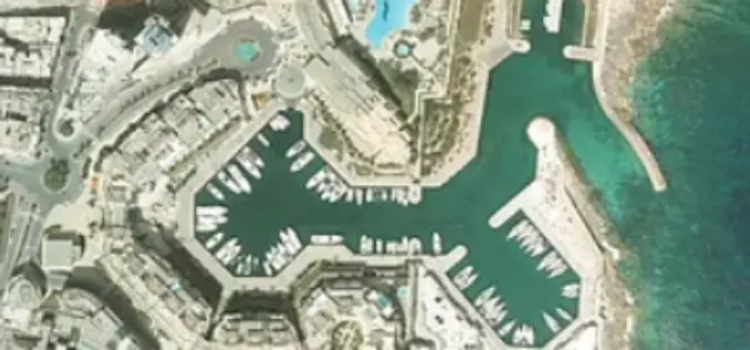
LiDAR Aerial Photo Bluesky Aerial Survey Helps Malta Develop GeoSpatial Infrastructure
July 31, 2018 – Aerial mapping company Bluesky has captured aerial photography and 3D map coverage of Malta. Working alongside tender lead IIC Technologies and Ordnance Survey, Bluesky captured ultra-high resolution

Bluesky LiDAR Data Used by RPS to Assess Flood Risk for Anglian Water
November 1, 2017 – A sewer flood risk map of the Anglian Water region is being created by the Wastewater Consultancy team of RPS. The highly accurate 3D digital map
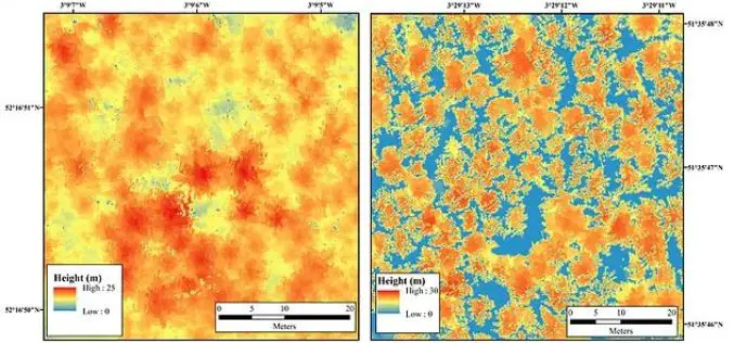
Bluesky LiDAR Maps Used to Monitor the Spread of Deadly Tree Disease
Laser maps collected by airborne mounted sensors have, for the first time, been used to successfully segment individual trees affected by the deadly Larch tree disease. The laser scanning surveys

Bluesky Launches New Online Resource for Geographic Information of Ireland
Aerial mapping company Bluesky has launched a new online Mapshop to serve the rapidly expanding mapping and geographic information industry in Ireland. With tens of thousands of square kilometres of

Bluesky Sponsors UNESCO Biosphere Reserve Expansion in Kenya
Leicestershire, 16 February 2016 – Aerial mapping company Bluesky is aiding the expansion of a UNESCO Biosphere Reserve in Kenya. Working with Cranfield University, the UK-based aerial survey specialist will provide
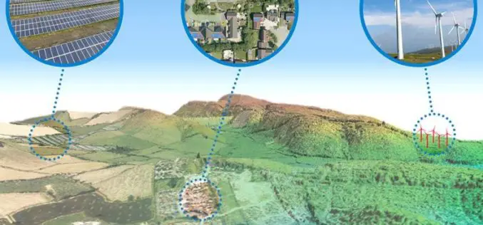
Aerial Mapping Pioneer Bluesky Supports Clean Energy Campaign
Aerial mapping company Bluesky is backing a charity’s campaign to protect the subsidies for clean energy projects. Under recent Government proposals, changes to the Feed-in-Tariffs (FiTs) for wind, solar and
