Scanning Hallstatt: RIEGL LiDAR Transforms Exploration of a World Heritage Landscape
A Multi-Scale Case Study Featuring Interactive Reports Now Available on the ESRI ArcGIS Map
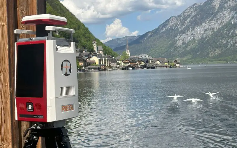
RIEGL is proud to present a groundbreaking LiDAR case study in Hallstatt, Austria, a UNESCO World Heritage Site recognized by the United Nations Educational, Scientific and Cultural Organization for its outstanding cultural and natural significance. Launched in 2025, the project highlights how RIEGL’sadvanced 3D laser scanning technology delivers powerful insights across diverse environments and scales, revealing new dimensions of one of Europe’s most iconic landscapes.
The Hallstatt project was designed to push the limits of LiDAR technology. From steep, hard-to-reach valleys and retreating glaciers to ancient salt mines, archaeological sites, and evolving vegetation, the region presents a diverse array of features for observation. These conditions make Hallstatt an ideal testbed for demonstrating the flexibility and precision of RIEGL’s sensor portfolio.
“The world heritage site Hallstatt is a breathtaking place well-known for its long-term history.” said Bernhard Groiss, RIEGL Senior Technical Expert LiDAR Applications. “For the last 8000 years humans have been present mining for salt, facing the everyday challenges of living in a harsh alpine environment and transforming the landscape into a unique cultural heritage site it is nowadays. Recording this place in 3D with all different types of LiDAR sensors developed by RIEGL is first a great honor but also an amazing chance to highlight the capabilities and characteristics of the diverse portfolio of RIEGL´s sensors and their efficient surveying workflows”. To meet the project’s ambitious goals, RIEGL deployed a combination of airborne and terrestrial LiDAR systems. The RIEGL VQ-840-GE Airborne Bathymetric LiDAR system was utilized to capture high-resolution bathymetric data in Hallstatt’s lakes and shallow water bodies. Its green laser technology enabled precise mapping of underwater terrain, even in areas with dense vegetation or low water clarity, providing critical insights into submerged archaeological features and hydrological dynamics.
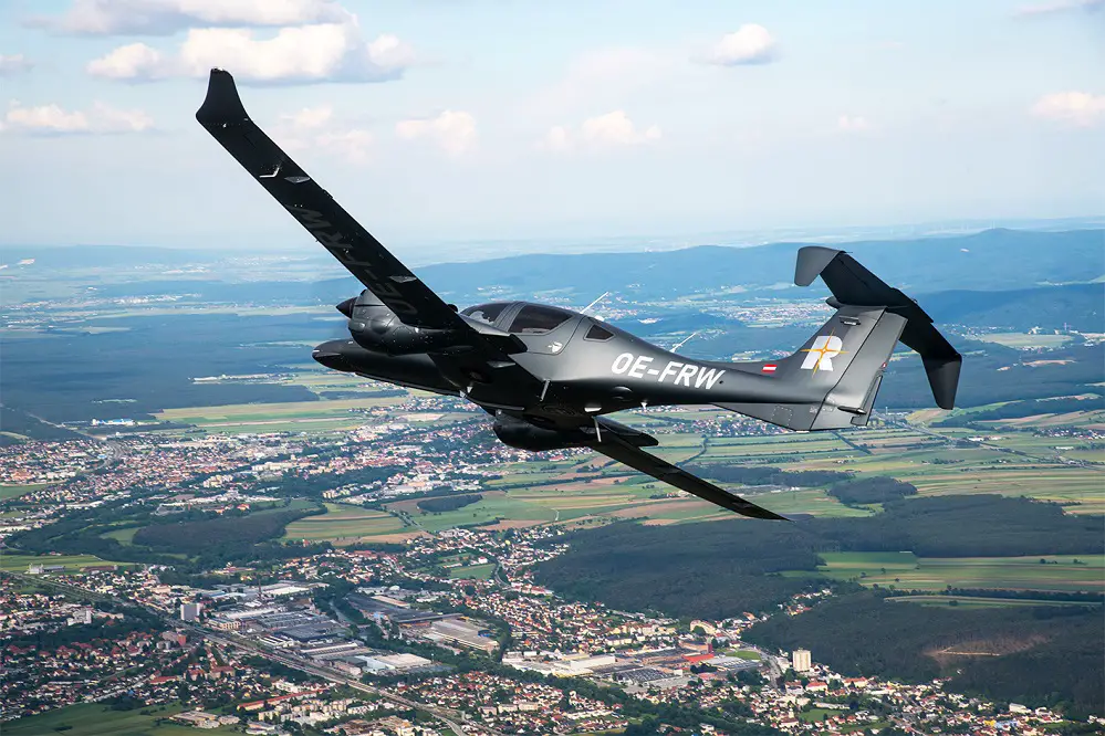
Left: RIEGL Aircraft with integrated RIEGL VQ-840-GE system 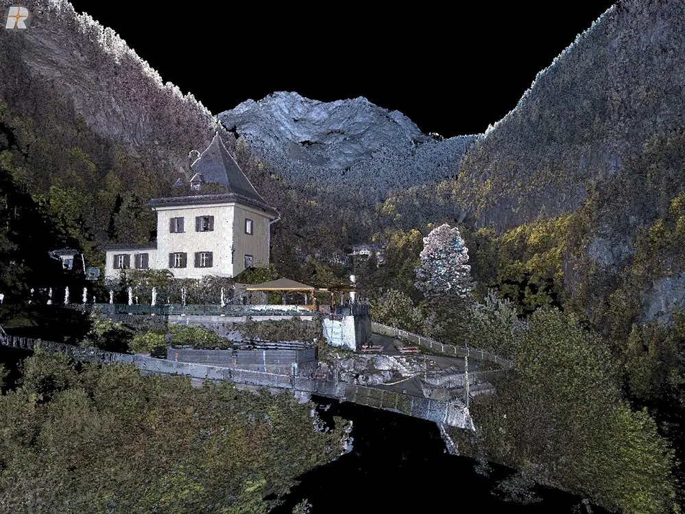
Right: RIEGL VZ-600i terrestrial data merged with VQ-840-GE bathymetric data providing detailed views of submerged structures
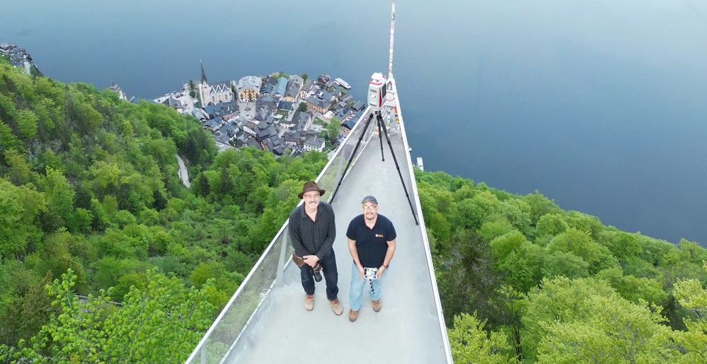
On land, the RIEGL VZ-4000i25 and VZ-600i Terrestrial Laser Scanners were deployed to document the region’s complex topography and cultural landmarks. The VZ-4000i25, with its extended range and high accuracy, was ideal for scanning expansive mountainous terrain and glacial features from a distance. Meanwhile, the VZ-600i offered ultra-high-speed data acquisition and fine detail resolution, making it perfect for capturing intricate architectural and archaeological structures within the historic village and surrounding sites. In this project, the VZ-600i was utilized in both static and kinematic modes, allowing the team to seamlessly transition between tripod-based scanning and mobile mapping workflows to efficiently cover diverse terrain and environments.
Left: Data captured with the RIEGL VZ-4000i25 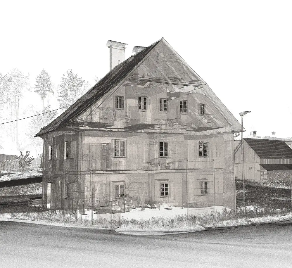
Right: Data captured with the RIEGL VZ-600i from the house of the former logging dam operator in Halstatt
RIEGL’s systems were deployed in both static and kinematic modes, operating on the ground and in the air to capture high-resolution data across a diverse range of survey scenarios. This project not only demonstrated the impressive capabilities of each individual sensor but also underscored the strength of RIEGL’sintegrated processing strategies. Leveraging precise georeferencing, these workflows enabled smooth data fusion and delivered comprehensive, multi-scale results that supported detailed analysis and visualization.
In today’s fast-paced world, timely access to reliable data is essential. RIEGL’s software tools support streamlined and high-performance processing and analysis, enabling users to generate actionable 3D insights even during field operations. This capability enhances decision-making and ensures that data is readily available for interpretation and long-term archiving
Experience how RIEGL LiDAR is redefining cultural heritage exploration, one scan at a time, with the first results from the Hallstatt project now available.
Explore the interactive reports from completed sub-projects through the ESRI ArcGIS Map: Case Study Hallstatt
Also, stay tuned for updates on further surveys happening at this historic location!
Special thanks to Dr. Matthias Kucera, RIEGL Manager of Sales & Support Services, whose initiative and leadership were instrumental in launching this project. His collaboration on the creation of the Esri ArcGIS Map brought the data to life in a compelling and accessible format. We also extend our appreciation to Bernhard Groiss, RIEGL Senior Technical Expert for LiDAR Applications, for his valuable technical support throughout the project. Additionally, we are grateful to Welterbe Salzkammergut and the Municipality of Hallstatt for their valued collaboration, which helped make this initiative a true success.
About RIEGL:
RIEGL is an international leading provider of cutting-edge technology in airborne, mobile, terrestrial, industrial and UAV-based laser scanning solutions for applications in surveying.
RIEGL has been producing LiDAR systems commercially for over 40 years and focuses on pulsed time-of-flight laser radar technology in multiple wavelengths.
RIEGL’s core smart-waveform technologies provide pure digital LiDAR signal processing, unique methodologies for resolving range ambiguities, multiple targets per laser shots, optimum distribution of measurements, calibrated amplitudes and reflectance estimates, as well as the seamless integration and calibration of systems.
RIEGL scanners offer a wide array of performance characteristics and serve as a platform for continuing Innovation in 3D for the LiDAR industry.
From the first inquiry, to purchase and integration of the system, as well as training and support, RIEGL maintains an outstanding history of reliability and support to their customers.
Worldwide sales, training, support and services are delivered from RIEGL’s headquarters in Austria and in the USA; main offices in Japan, China, Hong Kong, Australia, Canada, UK, France and Germany; and a worldwide network of representatives.