
Surveying

RICS Unveils First Global Standard for Responsible AI in Surveying
The Royal Institution of Chartered Surveyors (RICS) has introduced a landmark global framework to guide the responsible use of AI in surveying practice, marking a major shift in how digital
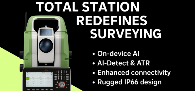
Next-Gen Leica TS20 Robotic Total Station Launched
Leica Geosystems, part of Hexagon, has unveiled the Leica TS20 robotic total station, a ground-up redesign that blends modern AI with rugged surveying hardware. With this release, Leica aims to

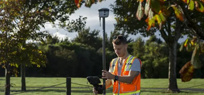
Comparative Analysis of GNSS Surveying Equipment: Trimble, Topcon, and Leica (2025)
In the field of surveying, precision and efficiency are paramount. GNSS (Global Navigation Satellite Systems) technology has revolutionized geospatial data capture, enabling real-time, highly accurate measurements. Leading manufacturers in this

Drones and ROVs for Dam Survey
The Uttar Pradesh (UP) government has initiated a significant project utilizing drones and remote vehicles to conduct the Rihand Dam survey. The Rihand Dam in the Sonbhadra district of Uttar
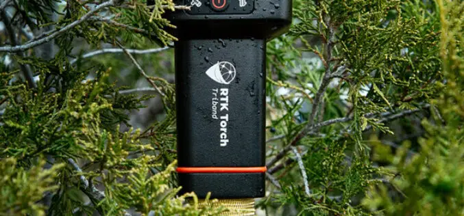
SparkFun Electronics Launch RTK Torch with Millimeter-Level Accuracy
SparkFun Electronics recently launched the RTK Torch, a high-precision GNSS product designed for various geolocation and GIS applications. This new device offers millimeter-level accuracy and is built to withstand tough

Efficiency, Safety, and Sustainability through Innovative Technology
STRABAG leverages innovative technology to make work more efficient, improve worker safety and drive sustainability in urban areas. Geospatial technologies and surveyors play a crucial role in developing infrastructure and
Revolutionizing Subsurface Exploration: Golden Software Unveils Latest Surfer® Mapping and 3D Visualization Package
Golden Software has elevated the capabilities of its Surfer mapping and 3D visualization software, providing users with an enhanced and comprehensive view of subsurface data. The latest version of Surfer
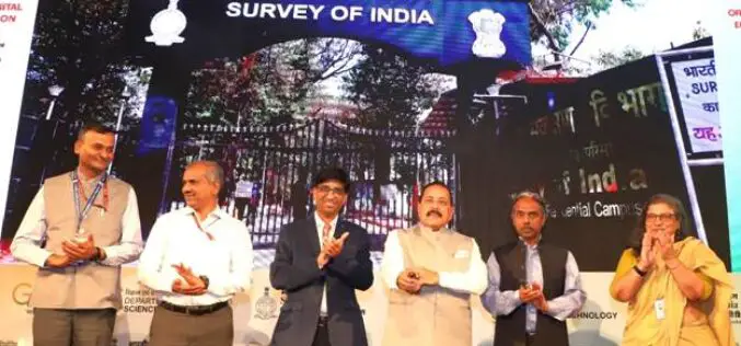
Union Minister Dr. Jitendra Singh Launches CORS Network Operated by Survey of India
In a significant stride towards bolstering India’s geospatial infrastructure, Union Minister Dr. Jitendra Singh inaugurated the nationwide CORS network operated by Survey of India. The cutting-edge initiative, known as the

Trimble Launches New IonoGuard Technology to Mitigate Ionospheric Disruptions
Trimble has introduced Trimble IonoGuard™, a next-generation technology designed to mitigate ionospheric disruptions in positioning and navigation by minimizing performance impacts caused by scintillation or signal noise. Referred to as
New Trimble R580 GNSS Receiver with Trimble ProPoint Delivers Survey Precision and Productivity in the Field
Trimble R580 Provides Cost-Effective High-Accuracy Reliable Positioning for Geospatial Applications Trimble has recently introduced the new Trimble® R580 Global Navigation Satellite System (GNSS) receiver, the next generation in its portfolio
