
Business

ESA and GEOSAT Join Forces to Accelerate Space Entrepreneurship and Sustainable Innovation
The European Space Agency (ESA) has signed a Letter of Intent with GEOSAT, marking an important milestone in advancing Europe’s space commercialisation landscape. Through ESA’s Partnership Initiative for Commercialisation (EPIC),

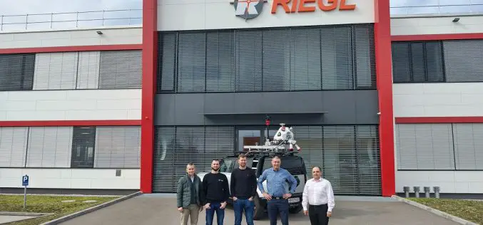
Innovation in Every Pulse: RIEGL’s New LiDAR Technologies
Introducing the latest advancements unveiled at INTERGEO Frankfurt 2025— engineered for precision, built for performance At INTERGEO Frankfurt 2025, RIEGL once again presents a broad range of innovations for the
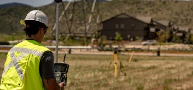
Trimble Ushers in New Era of Productivity and Connectivity with Comprehensive Data Collector Portfolio
Integrated Solutions Deliver Real-time Data, Streamlined Workflows and Enhanced Field Security Trimble® has announced the launch of its comprehensive data collector portfolio, marking a new era of productivity and connectivity for
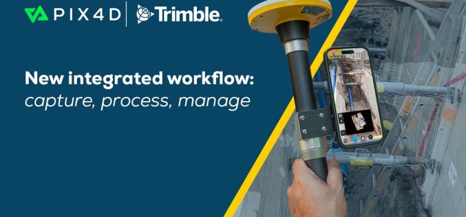
Pix4D To Provide An Accurate Data Capture Workflow With PIX4Dcatch And Trimble Connect
PIX4Dcatch is a user-friendly 3D scanning and AR visualization tool used by professionals in industries such as underground utility mapping and construction. Paired with the Trimble® Catalyst™ DA2 positioning system,

Scanning Hallstatt: RIEGL LiDAR Transforms Exploration of a World Heritage Landscape
A Multi-Scale Case Study Featuring Interactive Reports Now Available on the ESRI ArcGIS Map RIEGL is proud to present a groundbreaking LiDAR case study in Hallstatt, Austria, a UNESCO World

The Metop Second Generation A1 Satellite has been Successfully Launched from Europe’s Spaceport in Kourou
With a global audience watching in anticipation at launch events and online, Metop Second Generation A1 (Metop-SGA1) – also carrying the European Union’s Copernicus Sentinel-5 mission – lifted off on an Ariane-62

SFL Missions Inc. Included on Team Awarded Moon Mapping Study Contract by European Space Agency (ESA)
SFL Missions Inc. is a member of the team led by NUVIEW GmbH that has been contracted by the European Space Agency (ESA) to conduct a Pre-Phase A study,within a

Pix4D and Vision Aerial Partner to Deliver Drone Mapping Solutions
Pix4D, a global leader in photogrammetry and geospatial software solutions, is proud to announce a new partnership with Vision Aerial, a leading U.S.-based manufacturer of professional drones designed to increase
Field Geospatial Enhances Global Leadership with Cutting-Edge RIEGL Mobile Mapping Technology in the Nordic Regions
Field (Field Geospatial AS) is a premier Norwegian technology and geomatics company renowned for its expertise in collecting and analyzing geographical data. Specializing in aerial data capture, mobile mapping, and

Xona Space Systems Announces Collaboration with Trimble to Deliver Next-Gen Navigation Services
Xona Space Systems (Xona), a leading pioneer of advanced commercial satellite navigation solutions announces a new collaboration with Trimble® (Nasdaq: TRMB), a global leader in construction, transportation and geospatial technology. Xona and Trimble
