
LiDAR

V.O. Chidambaranar Port Becomes India’s First Major Port to Deploy a Geospatial Digital Twin
India has taken a major step in smart port infrastructure: V.O. Chidambaranar Port Trust (VOC Port) in Tuticorin, Tamil Nadu, has become the first Indian major port to implement a

Mysuru City Corporation to Deploy Aerial LiDAR Mapping for Property Tax Reform
The Mysuru City Corporation (MCC) in Karnataka, India, has announced plans to implement Aerial LiDAR mapping technology from April 2026 to create a comprehensive, three-dimensional property map of the entire
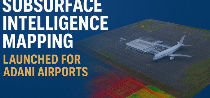
Subsurface Intelligence Mapping: Genesys Launches India’s First 3D Survey of Adani Airport
In a major stride toward India’s infrastructure modernisation, Genesys International has launched the country’s first comprehensive 3D subsurface mapping project, specifically for six airports operated by Adani Group. The contract,

Kathmandu Explores LiDAR for 3D City Mapping
Kathmandu Metropolitan City (KMC) has recently announced plans to explore advanced LiDAR-based surveys to build detailed three-dimensional maps and a city-wide digital twin. In a recent session by the city’s
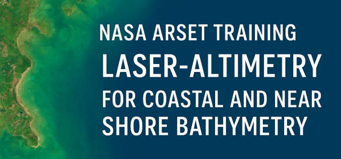
NASA ARSET Training Opportunity for Coastal Mapping: Coastal Laser-Altimetry
The NASA Applied Remote Sensing Training Program (ARSET) is inviting remote-sensing professionals and geospatial analysts to join a live online training titled “NASA Satellite Laser Altimetry for Coastal and Near-Shore

Satellite Laser Ranging Technique Reveals Accelerated Sea-Level Rise
Researchers from Hong Kong Polytechnic University (PolyU) have unveiled a new satellite laser ranging technique that quantifies the accelerated rise in global sea levels over the last 30 years. Their

Hyderabad CM Orders LiDAR Survey to Prevent Encroachments on Water Bodies
Hyderabad Chief Minister A. Revanth Reddy has instructed officials to conduct an extensive LiDAR survey of lakes, nalas (drains), and other water bodies to curb illegal encroachments. The advanced remote-sensing
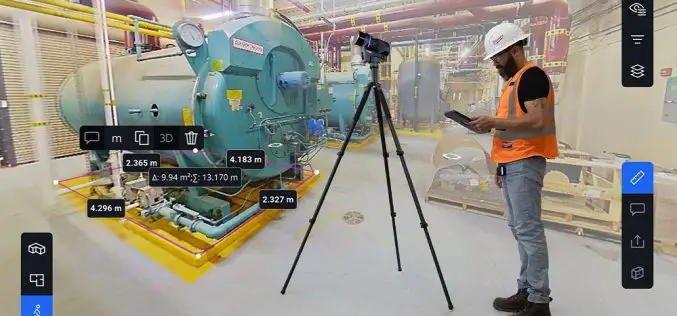
FARO Launches Blink for Simplified 3D Data Capture
FARO Technologies has officially unveiled Blink, a new innovation that aims to revolutionize 3D data capture by making it faster, easier, and more intuitive. Blink offers real-time, high-quality spatial data

University of Missouri Develops LiDAR-based Traffic Safety Systems
Researchers at the University of Missouri are pioneering the integration of light detection and ranging (LiDAR) technology with artificial intelligence (AI) to enhance transportation safety, focusing on the interactions among

LiDAR-Powered Cycling Safety in the Netherlands
The Netherlands, a country renowned for its cycling culture, is taking a major step forward in road safety with LiDAR-powered cycling safety solutions. Researchers at Delft University of Technology have
