
GLONASS Signals
GLONASS satellite transmits signals on a slightly different L1 and L2 frequency, with the P-code (HP code – high precision) on both L1 and L2, and the C/A code (SP code – standard precision), on L1 (all satellites) and L2 (most satellites). GLONASS satellites transmit the same code at different frequencies, a technique known as FDMA, for frequency division multiple access.
The transmitted signals within two bands: Ll, 1602.0–1615.5 MHz, and L2, 1246.0–1256.5 MHz, at frequencies spaced by 0.5625 MHz at L1 and by 0.4375 MHz at L2. This arrangement provided 25 channels, so that each satellite in the full 24-satellite constellation could be assigned a unique frequency.
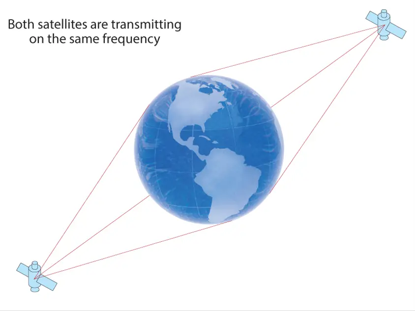
The system now uses only 14 primary frequency channels to serve 24 satellites. This can be achieved by using identical frequency channels to support antipodal (opposite side of planet in orbit) satellite pairs, as these satellites will never be in view of an earth based user at the same time.
Source: https://novatel.com/an-introduction-to-gnss/chapter-3-satellite-systems/..
All satellites transmit the same code as their SP signal; however the HP signal is broadcast in phase quadrature with the SP signal, effectively sharing the same carrier wave as the SP signal, but with a ten times higher bandwidth than the SP signal.
The L2 signals use the same FDMA as the L1 band signals, but transmit straddling 1246 MHz with the center frequency determined by the equation 1246 MHz + n×0.4375 MHz, where n spans the same range as for L1. Other details of the HP signal have not been disclosed.
At peak efficiency, the SP signal offers horizontal positioning accuracy within 57–70 meters, vertical positioning within 70 meters, velocity vector measuring within 15 cm/s, and timing within 1 µs, all based on measurements from four satellite signals simultaneously. The more accurate HP signal is available for authorized users, such as the Russian Military.
Currently, an additional civil reference signal is broadcast in the L2 band with an identical SP code to the L1 band signal. This is available from all satellites in the current constellation, except satellite number 795 which is the last of the inferior original GLONASS design, and one partially inoperable GLONASS-M satellite which is broadcasting only in the L1 band. (see glonass-ianc.rsa.ru for daily updates on constellation status.)
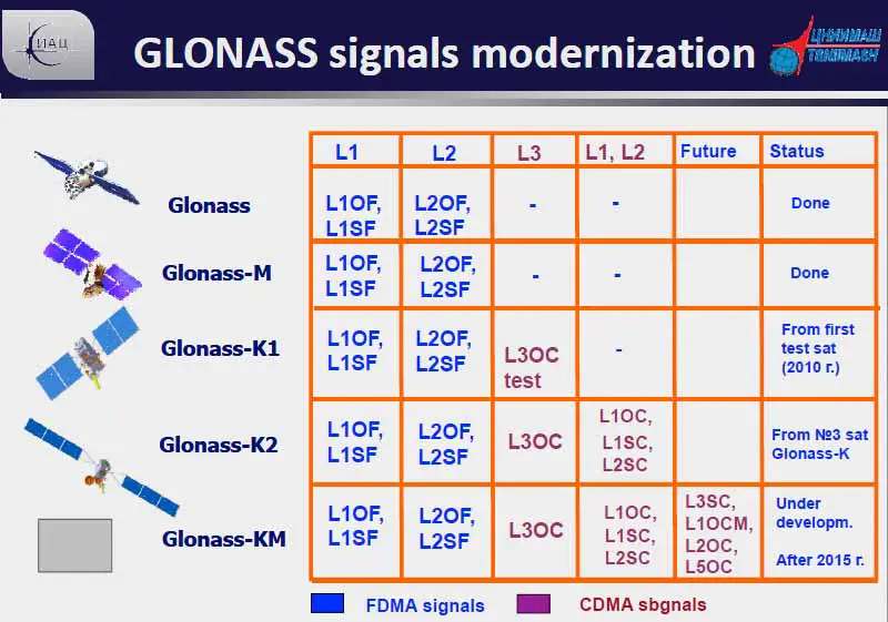
The present GLONASS-M satellites will be replaced with the next-generation GLONASS-K satellites as they near the end of their service life. The new signals will be –
- L3 – The new civil signal L3, centred at 1202.025 MHz, will be transmitted by the first block of GLONASS-K satellites (GLONASS-K1). Unlike conventional GLONASS signals, L3 is based on CDMA, making it easier to integrate with GPS and Galileo. In February 2011, the first GLONASS-K1 satellite was launched.
- L1 and L2 CDMA – GLONASS-K2 adds two extra CDMA-based signals broadcast at the L1 and L2 frequencies to the second block of GLONASS-K satellites. To support legacy receivers, the existing FDMA L1 and L2 signals will continue to be broadcast. Starting in 2015, GLONASS-K2 satellites will be launched.
- L5 – The GLONASS system will receive an L5 signal from the third block of GLONASS-K satellites (GLONASS-KM).
GLONASS Time and Ephemeris
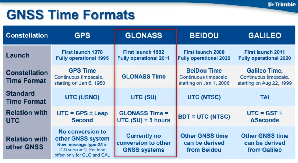
GLONASS uses the Coordinated Universal Time of Russia (UTC) version. The Main Metrological Center of Russian Time and Frequency Service (VNIIFTRI) at Mendeleevo monitors and corrects the epoch and rate of Russian time in relation to UTC (BIH) on a regular basis (Moscow Region).
They establish the regional version of UTC known as UTC (SU). There is a constant offset of 3 hours between GLONASS Time and UTC (SU). GLONASS Central Synchronizer,CS, time is the foundation of GLONASS time, GLONASST. The GLONASS-M satellites are equipped with cesium clocks which are kept within 8 nanoseconds of GLONASST.
GLONASS Coordinate Datum
GLONASS uses a coordinate datum named “PZ 90” (Parametry Zemli 1990), in which the precise location of the North Pole is given as an average of its position from 1900 to 1905. This is in contrast to the GPS’s coordinate datum, WGS 84, which uses the location of the North Pole in 1984. As of September 17, 2007 the PZ-90 datum has been updated to differ from WGS 84 by less than 40cm in any given direction.
Also Read –
