
Posts From GIS Resources

New vs. Used Utility Locators: A 2026 Cost and Ownership Study
A used utility locator can cut the initial equipment cost by several thousand dollars. That doesn’t automatically make it the cheaper machine to own. Contractors comparing new and used Radiodetection

How Digital Utility Maps Support Safer Infrastructure Planning
Infrastructure planning has always depended on one essential question: what is already in the ground? Before a road is widened, a housing development is approved, a drainage system is redesigned,
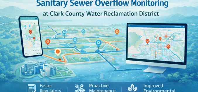
Esri GIS Spatial Analysis Transforms Sanitary Sewer Overflow Monitoring at Clark County Water Reclamation District
Clark County Water Reclamation District (CCWRD) in Nevada has deployed a fully automated GIS spatial analysis workflow using Esri’s ArcGIS platform to revolutionise how it monitors, reports, and responds to

V.O. Chidambaranar Port Becomes India’s First Major Port to Deploy a Geospatial Digital Twin
India has taken a major step in smart port infrastructure: V.O. Chidambaranar Port Trust (VOC Port) in Tuticorin, Tamil Nadu, has become the first Indian major port to implement a

China Announces In-Orbit Upgrade for BeiDou Satellite Navigation System in 2026
China’s BeiDou Navigation Satellite System (BDS) is set to undergo a significant in-orbit upgrade, the China Satellite Navigation Office announced on 13 March 2026. The upgrade will improve signal accuracy,

NAC and NRSC Sign MoU to Integrate Geospatial Training into Construction Sector
The National Academy of Construction (NAC) and the National Remote Sensing Centre (NRSC), a primary earth observation centre of the Indian Space Research Organisation (ISRO), have signed a Memorandum of

India Launches GIS-Based Dam Safety Platform and AI Tool NETRA for National Dam Monitoring
India has launched a suite of digital tools to strengthen the monitoring and governance of dam safety, including a GIS-based interactive mapping interface and an AI-powered inspection analysis platform called
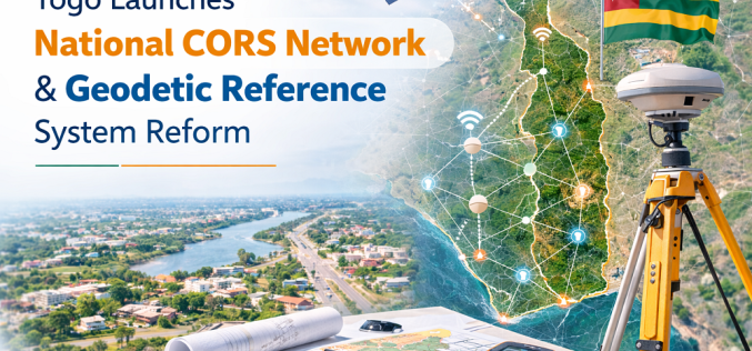
Togo Launches National CORS Network and Geodetic Reference System to Standardise Spatial Data
The Government of Togo announced on 9 March 2026 a comprehensive reform of its national geodetic reference system, including the installation of a nationwide CORS network and the establishment of

Mysuru City Corporation to Deploy Aerial LiDAR Mapping for Property Tax Reform
The Mysuru City Corporation (MCC) in Karnataka, India, has announced plans to implement Aerial LiDAR mapping technology from April 2026 to create a comprehensive, three-dimensional property map of the entire
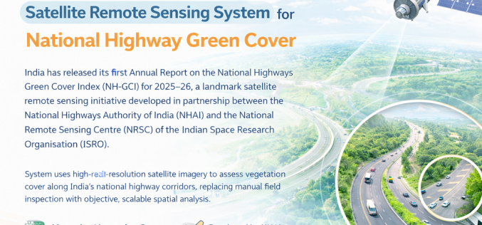
India Launches Satellite Remote Sensing System for National Highway Green Cover
India has released its first Annual Report on the National Highways Green Cover Index (NH-GCI) for 2025–26, a landmark satellite remote sensing initiative developed in partnership between the National Highways
