Free GIS Data – Natural Disasters Data
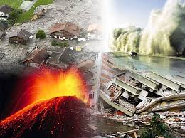
Natural Disasters Data
- Natural Disaster Hazards: Hazard Frequency, Mortality and Economic Loss Risk as gridded data for the globe. Covers cyclones, drought, earthquakes, flood, landslide, volcano and a combination of them all (‘multihazard’).
- USGS Earthquakes Database: KML files of all earthquakes recorded by the USGS (across the whole world) from 1973 to present. Available as one dataset or grouped by magnitude or year.
- Global Seismic Hazard Map: Gridded data showing hazard risk of seismic activity across the globe.
- IBTrACS: Hurricane and tropical cyclone tracks, including attributes such as minimum pressure, maximum winds.
- NOAA/WDC Historical Tsunami Database: Location information of tsunami sources and run-up events, including many attributes (eg. maximum water height, travel time). Available in TSV format which can be imported into GIS systems.
- Global Burnt Area: 1km resolution map of areas of burnt vegetation across the world. Aggregated products at 0.5 and 1 degree resolutions are also available.
- MODIS Fire Detection Data: Frequently updated data (including last 7 days of fires) in 1km grid format, derived from thermal anomalies from MODIS data.
- Lightning and Atmospheric Electricity Dataset: Wide range of data on lightning activity, including average flashes per grid cell per year.
- NOAA Historical Hurricane Tracks: Hurricane tracks for all North/Central American hurricanes.Data can be exported by clicking the Download button on the top right.
- Natural Disaster Hotspots: A wide range of geographic data on natural disasters (including volcanoes, earthquakes, landslide, flood and ‘multihazards’) with hazard frequency, economic loss etc.
Categories:
GIS Data


