
GIS Data
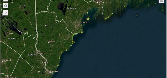
Maine Geological Survey Uses Real-Time Kinematic to Update Maine Beach Data
The Maine Geological Survey (MGS) has updated its Maine Beach Mapping (MBMAP) viewer with the latest data gathered during the summer of 2024. This update highlights critical changes to Maine’s
U.S. Census Bureau Geospatial Data Now in GeoPackage Format
The U.S. Census Bureau recently unveiled a major update with the release of new geospatial data that includes the TIGER/Line files in GeoPackage format for the first time. This dataset,
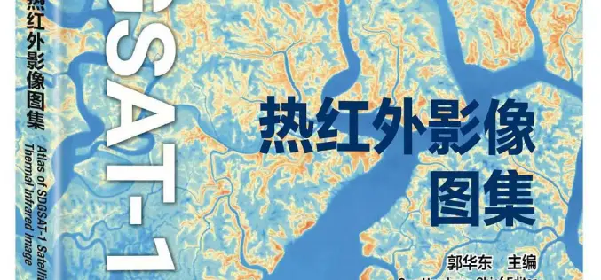
China Unveiled World’s First Thermal Infrared Atlas
China has made a groundbreaking contribution to global sustainability efforts by releasing the world’s first Thermal Infrared Atlas. The atlas was launched during the 4th International Forum on Big Data
GeoDiscovery Offers Self-Serve Access to Geospatial Data from AGSL and UWM
The University of Wisconsin-Milwaukee (UWM) has recently unveiled GeoDiscovery, an innovative geoportal developed in collaboration between the American Geographical Society Library (AGSL) and the Digital Collections & Initiatives (DC&I) department.

The Power of Geodetic Data: Accessing GGOS Portal for Research and Analysis
The Global Geodetic Observing System (GGOS) portal is a centralized access point for geodetic data. It provides access to a wide range of data related to Earth’s gravity field, geodetic
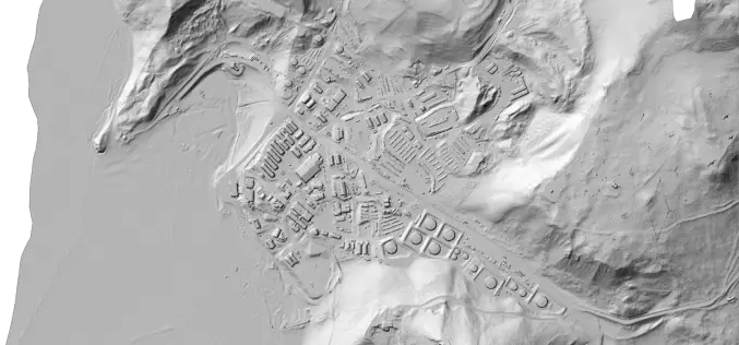
Portland State Laser Mapping Project Shows Global Warming Effects in Antarctica
(Portland, Ore.) Aug. 9, 2017 – Portland State University researchers and the National Science Foundation (NSF) have publically released high-resolution maps of the McMurdo Dry Valleys, a globally unique Antarctic

Airbus and CSTARS Provide “WorldDEM Ocean Shoreline” for Uniquely Accurate Coastline Mapping
Homogeneous, gap-free and single source vector product delineates world’s ocean shorelines detailed and up-to-date Friedrichshafen, 29 May 2017 – Airbus Defence and Space expands its WorldDEM portfolio with the launch
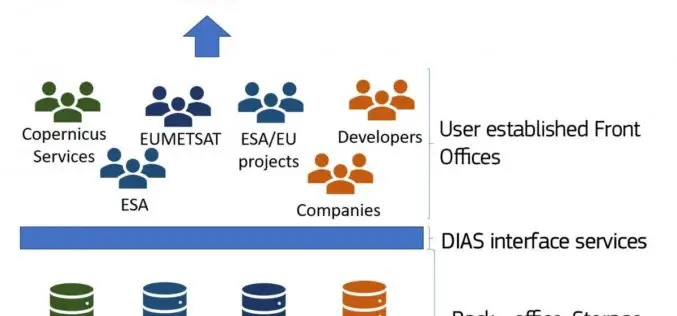
The Upcoming Copernicus Data and Information Access Services (DIAS)
The European Commission (EC) has launched an initiative to develop Copernicus Data and Information Access Services (DIAS) that facilitate access to Copernicus data and information from the Copernicus services. By

China Adopts Revised Surveying and Mapping Law – Protecting National Security & Raising Public Awareness
China – April 28, 2017 – China’s top legislature Thursday passed a revised surveying and mapping law, protecting geographic information security and raising public awareness of national territory. The legislation

Europa Technologies Celebrates Earth Day with New Release of Global Data Suite
In tribute to Earth Day 2017, Europa Technologies has announced the latest major version (v2017.1) of its market-leading suite of global map data products. As a publisher of rich data
