GeoDiscovery Offers Self-Serve Access to Geospatial Data from AGSL and UWM
The University of Wisconsin-Milwaukee (UWM) has recently unveiled GeoDiscovery, an innovative geoportal developed in collaboration between the American Geographical Society Library (AGSL) and the Digital Collections & Initiatives (DC&I) department.
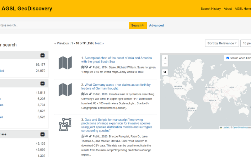
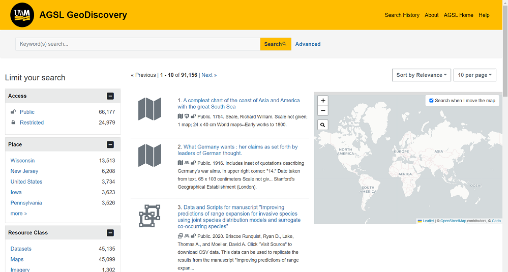
This portal, powered by GeoBlacklight, an open-source platform, allows users to access and download geospatial data and maps from AGSL’s vast collection as well as from other institutions, thanks to the integration of OpenGeoMetadata.
Streamlined Access to Geospatial Data
Previously, accessing geospatial data from AGSL required users to submit data requests. With the launch of GeoDiscovery,
AGSL has been a cornerstone of geographic research for decades. Founded in 1978, following the transfer of the American Geographical Society’s collections to UWM, AGSL is one of the largest repositories of geographic data in the world. Its collections, which include over 2 million items, range from historical maps and atlases to photographs, globes, and digital geospatial datasets.
Also Read – Explore Great Britain with OS’s Ultimate Adventure Planning Tool
A Collaborative Effort
The development of GeoDiscovery was the result of collaborative efforts by UWM staff. Contributions came from key figures such as Stephen Appel from AGSL, and Jie Chen, Karl Holten, Ann Hanlon, and Nathan Humpal from DC&I and Collection and Resource Management. Additionally, external developer Eric Larson played a vital role in building the front-end application, ensuring that the platform is user-friendly and accessible.
Powering GeoDiscovery with OpenGeoMetadata
One of the most significant features of GeoDiscovery is its ability to integrate data from other institutions through OpenGeoMetadata. This initiative collects metadata from multiple sources, allowing for enhanced data sharing and accessibility. As a result, users can not only discover AGSL’s vast collections but also access maps and data from other geographical institutions across the globe.
Expanding Geospatial Research
GeoDiscovery represents a major step forward in expanding access to geospatial resources. Whether researchers are looking for historical cartographic data or modern digital datasets, the portal makes it easier to find, download, and utilize these resources.
If you have any questions or problems, please contact gisdata@uwm.edu.