The June update of ArcGIS Online features improvements to item pages, updated content, and more options for administrators.
Improved Item Pages
Check out the redesign. It includes better work flows, performance, and layout. There’s also new functionality to help you explore and work with content. Now it’s easier to:
- Navigate and edit feature data
- View all aspects of a field together
- Configure feature layer styles and pop-ups
- Create configurable apps from maps or scenes
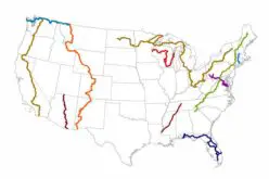
Credit: Esri
Web AppBuilder for ArcGIS
Find new widgets that will make it even easier (and more fun) for you to build web applications in ArcGIS. And now you can use the Add Color Picker theme to choose your own color or match an approved color palette. New widgets include:
- Select: Other widgets take an action on the selected features.
- Share: A social sharing experience of apps.
- Add Data: Search for layers in ArcGIS Online and enter URLs to add data to a map.
- Enhanced Query: Add spatial relationships, such as intersect, overlap, and contain, to perform the query against features in another layer then export as CSV, GeoJSON, or feature collection.
- Oblique Viewer: Display images in their native coordinate system to pan in oblique mode or single viewing angle, or switch angles.
Credit: Esri
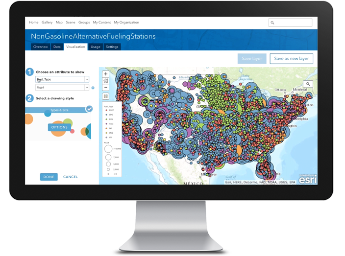
Map Viewer
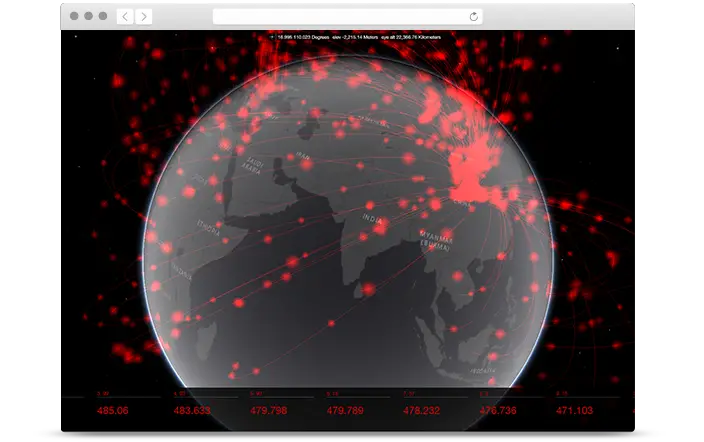
Smart mapping keeps getting smarter. New styles will help you understand your data from a temporal perspective. Use the Continuous Timeline (Color) or Continuous Timeline (Size) smart mapping styles to view dates sequentially on a map. For example, use color to see how the rate of measles immunizations changed in the weeks before and after the launch of a pro-immunization campaign.
Scene viewer
- Integrated mesh support—a new layer type for UAV- or airplane-based photogrammetric 3D scans of surfaces (published by Drone2Map for ArcGISand third-party vendors).
- Custom 3D object symbols—point layers can now be used for placing arbitrary 3D objects such as street furniture or cartographic 3D elements (published by ArcGIS Pro 1.3).
- Performance-quality switch—optimizes the user experience in Internet Explorer (more stability) as well as on high-end devices (more appealing visualizations).
- Daylight & shadow animation—new Daylight tool introduces sunlight and shadow animation over a day or a whole year.
- Miscellaneous improvements—polished viewer GUI, enhanced UX for ground elevation layers, and support in global scenes for tile layers and basemaps in WGS84 coordinate system, as well as various bug fixes.
Credit: Esri
Open standards
ArcGIS Online continues to improve its commitment to standards and interoperability with enhanced support for Open Geospatial Consortium (OGC) services. The following functionality is now supported:
- Pop-ups can be enabled in OGC Web Map Service (WMS) layers.
- OGC Web Feature Service (WFS) layers can be added to maps and as items.
- Third-party OGC Web Map Tile Service (WMTS) services can be added as items.
For a complete list and more details on what’s new, see ArcGIS Online Help.