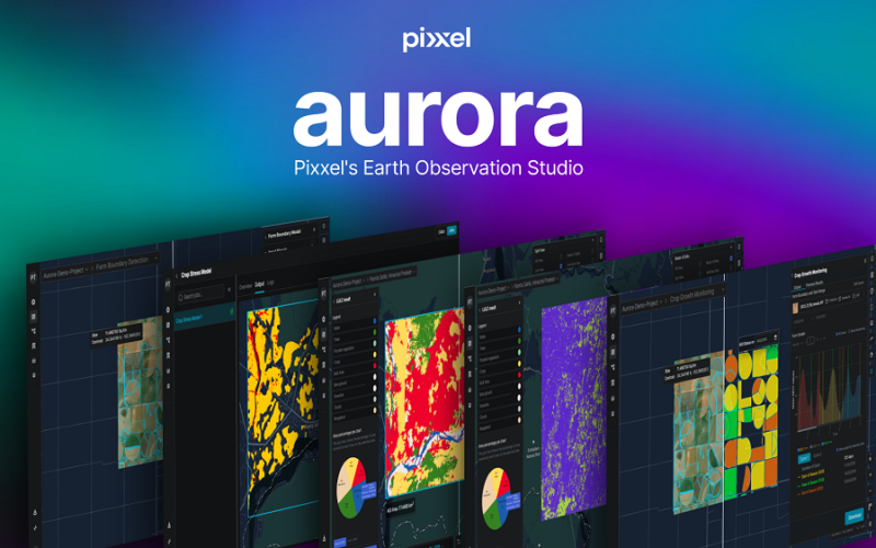
Pixxel, a Bengaluru-based space tech startup, has launched “Aurora,” an advanced Earth Observation (EO) Studio designed to revolutionize satellite data analysis. This platform simplifies the traditionally complex process of remote sensing by providing a no-code environment where users can easily interact with satellite imagery. Aurora supports a wide range of open-source and commercial datasets, with plans to integrate Pixxel’s hyperspectral imagery by the end of 2024.
This innovative platform is designed to simplify the analysis of satellite imagery, making it more accessible and intuitive for users across various industries.
Aurora is equipped with several indices, including the Normalised Difference Vegetation Index (NDVI) for assessing vegetation health, the Normalised Difference Water Index (NDWI) for estimating water surface area and monitoring floods, and the Oil Spill Index for detecting and monitoring oil spills on water surfaces.
These features make Aurora a versatile tool with applications in monitoring forest health, carbon stocks, precision agriculture, and tracking land use changes.
Aurora advances geospatial data analysis by providing precise and pertinent information tailored to compliance and business needs. It caters to various industries and applications, maximizing the effectiveness of geospatial intelligence.
Upcoming updates to Aurora will further its capabilities by facilitating data integration across large Areas of Interest (AOIs). Users will be able to merge hyperspectral data with other Earth observation datasets and upload ground truth data, leading to a more thorough analysis.
Pixxel, known for its hyperspectral earth imaging technology, is positioning Aurora as a game-changer in how remote sensing data is accessed, interpreted, and utilized.
According to Pixxel’s CEO, Awais Ahmed, the focus was on creating a platform that delivers insights quickly without the need for complex data processing steps.
Aurora aims to empower organizations of all sizes in sectors like agriculture, forestry, mining, and climate technology, providing them with the tools to make informed decisions based on real-time Earth observation data.
Source: Pixxel


