India Liberalizes Guidelines for Acquiring and Producing Geospatial Data and Geospatial Data Services Including Maps
A long-waited wish of geospatial professional full-filled when the Department of Science and Technology (DST) has opened access to its geospatial data and services, including maps, for all Indian entities.
The announcement is based on the thought, “what is readily available globally does not need to be regulated.” The move is said to release a lot of data that is currently restricted and not available for free.
The Government of India acknowledges that the availability of comprehensive, highly accurate, granular and constantly updated representation of Geospatial Data will significantly benefit diverse sectors of the economy and will significantly boost innovation in the country and greatly enhance the preparedness of the country for emergency response
In a series of tweets, Prime Minister Narendra Modi said, India’s farmers will also be benefited by leveraging the potential of geospatial & remote sensing data.
Liberalisation of the mapping industry and democratization of existing datasets will spur domestic innovation and enable Indian companies to compete in the global mapping ecosystem by leveraging modern geospatial technologies.
The availability of data and modern mapping technologies to Indian companies is also crucial for achieving India’s policy aim of Atmanirbhar Bharat and the vision for a five trillion-dollar economy. India presently relies heavily on foreign resources for mapping technologies and services.
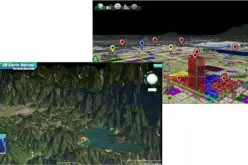
Geospatial data which includes location information are data about the natural or man-made, physical or imaginary features whether above the ground or below, boundaries, points of interest, natural phenomena, mobility data, weather patterns, statistical information, etc.
There has been immense progress over the years in technology for capture of geospatial data through ground-based survey techniques, photogrammetry using manned/unmanned aerial vehicles, terrestrial vehicle mounted Mobile Mapping System, LIDAR, RADAR Interferometry, satellite-based remote sensing, mobile phone sensors and other techniques.
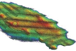
The official guidelines on geospatial data acknowledge the role of Geospatial Data in the Blue economy. Bathymetric Geospatial Data would be crucial for the attainment of a flourishing and vibrant blue economy for the country and would require the active participation of private sector in the acquisition and their use apart from traditional agencies like Navy, etc.
All citizens, companies, and organizations including Government agencies,
producing Geospatial Data and information shall be encouraged to
collaborate in a mutually beneficial manner and work towards open-linked
Geospatial Data. Government agencies will make all efforts to collaborate
for acquiring Geospatial Data.
Read Also-


