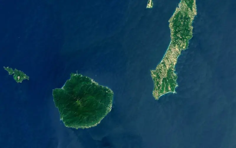

This Landsat 8 satellite image of some southern Japanese islands includes Tanegashima (far right), from where the Global Precipitation Measurement, or GPM, mission’s Core Observatory is scheduled to blast into orbit aboard a Japanese H-IIA rocket. This image was taken on April 13, 2013. The GPM satellite is scheduled for launch during a window that opens at 3:07 a.m. in Japan on Feb. 28, 2014 (due to the time difference with the United States, that’s 1:07 p.m. EST on Feb. 27). The GPM satellite measure rain and snowfall over most of the globe.
GPM is an international mission led by NASA and the Japan Aerospace Exploration Agency to measure rain and snowfall over most of the globe multiple times a day. To get that worldwide view of precipitation, multiple satellites will be contributing observations for a global data set, all unified by the advanced measurements of GPM’s Core Observatory, built at NASA’s Goddard Space Flight Center in Greenbelt, Md.
Landsat 8 (formerly called the Landsat Data Continuity Mission, or LDCM) continues the Landsat program’s critical role in monitoring, understanding and managing the resources needed for human sustainment such as food, water and forests. Landsat 8 is a collaboration between NASA and the U.S. Geological Survey.
› Labeled image
› NASA’s GPM website
› NASA’s Landsat website
Image credit: NASA/USGS; Mike Taylor
Text credit: Rob Gutro, NASA’s Goddard Space Flight Center, Greenbelt, Md.