
Tag "GeoNews"
Esri Releases Advanced Analytics to Increase Retail Sales
Indoor Spatial Analysis of Consumer Behaviors Boosts Profits and Increases Customer Satisfaction January 17, 2017 – Redlands, California—Esri, the global leader in spatial analytics technology, today announced a partnership with GISinc
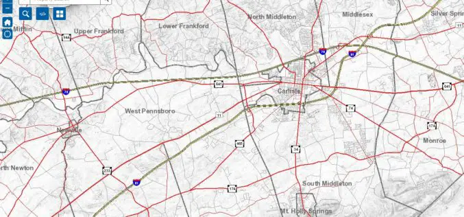
Cumberland County Launches New Property Mapper Application
Cumberland County, PA, January 3, 2017- At their public meeting today, the Cumberland County Board of Commissioners announced the release of a new online property mapper application now available to

Maharashtra Forest Dept Gets New GIS Based Command Centre to Monitor Forest Reserve
Maharashtra – According to recent news by The Hindustan Times, in a first for the country, the Maharashtra State Forest Department will use real-time satellite images of all forested areas
DGCA to Airlines: Use GAGAN or Face Consequence
Mumbai – According to recent news by the Mumbai Mirror, the government has warned domestic airlines of `consequences’ if they did not adopt the Rs 774 crore GPS-Aided Geo Augmented
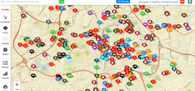
Raleigh Police Department Launches Crime Mapping Tool
Raleigh, North Carolina Nov. 21, 2016- The Raleigh Police Department has launched an online crime-mapping tool that helps people to learn of crimes reported in areas that are of interest to them.
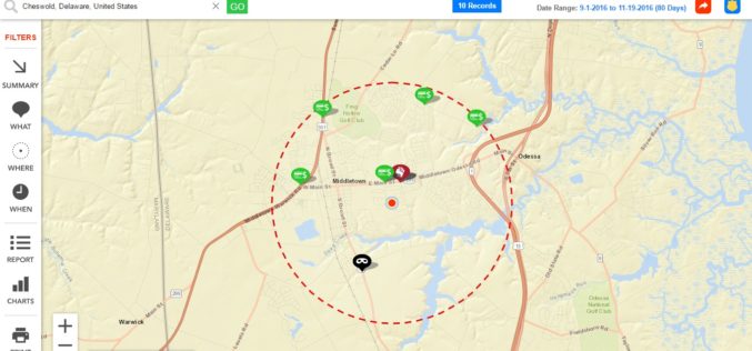
Delaware State Police Announces Crime Mapping Website
Delaware, USA Nov. 17, 2016 – Crime mapping is one tool that serves that purpose and is an extraordinary example of Delaware State Police (DSP) effort to leverage technology to
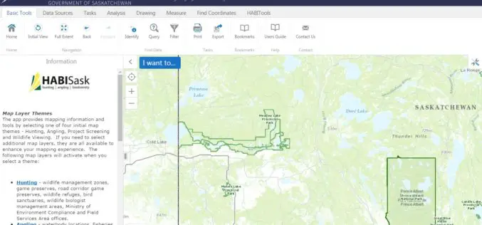
Government of Saskatchewan Launches New Hunting, Angling and Biodiversity Mapping Tool
The Ministry of Environment, Saskatchewan launched a new client-centred, online mapping tool called HABISask (Hunting, Angling and Biodiversity Information of Saskatchewan) that combines new and existing information on hunting, angling,
Esri Boosts Higher Education in Ethiopia
Company Donates Cloud-Based GIS Solutions to More Than 30 Schools Redlands, California—Smart mapping leader Esri announced an agreement between Esri Eastern Africa Limited and the Federal Democratic Republic of Ethiopia
Esri Maps the Way to a More Connected World at IoT West
Telecom Expert Explores the Ways Location Forms the Missing Link in the IoT Ecosystem Redlands, California—Global smart-mapping leader Esri today announced that telecom executive Randy Frantz will be featured at

Iran Defines 7 Projects to Use Remote Sensing for Monitoring Agriculture
According to recent news by the Mehr news Agency, the Iranian Space Agency has defined 7 mega projects in the field remote sensing for monitoring agricultural products with high precision. Mohammad
