
Tag "GeoNews"

Bluesky Launches New Online Resource for Geographic Information of Ireland
Aerial mapping company Bluesky has launched a new online Mapshop to serve the rapidly expanding mapping and geographic information industry in Ireland. With tens of thousands of square kilometres of
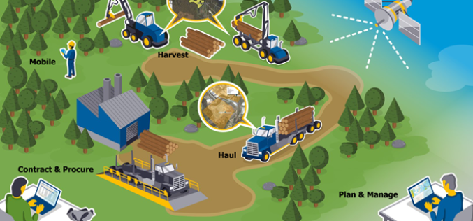
New Forests to Manage its Asian-Based AFI Investment with Trimble’s Connected Forest Solution
SUNNYVALE, Calif., March 22, 2017—Trimble (NASDAQ: TRMB) announced today that New Forests, a Sydney-based sustainable real assets investment specialist, will implement Trimble’s Land Resource Manager (LRM) solution to manage its
Gender Data in GIS Helps Reduces Climate Change Impacts
New Delhi, India – Gender in Geographic Information System (GIS), though new, plays a significant role in helping disaster risk management, and reducing environmental and climate change impacts in vulnerable
Geospatial Information and Technology Association (GITA ) 2017 Scholarship Program
Geospatial Information and Technology Association (GITA ) is involved in professional education activities throughout the year generate funds which are used to award scholarships to deserving students. These scholarships are
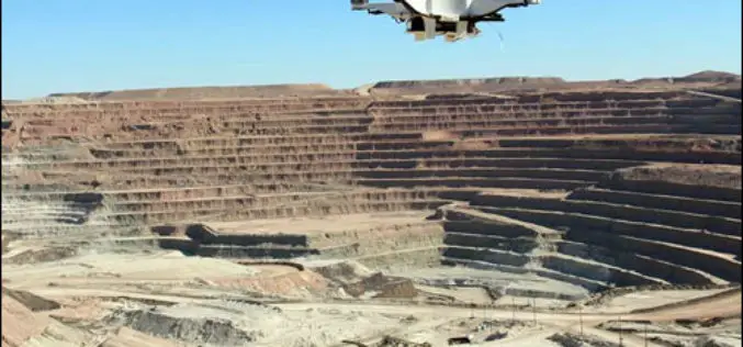
Drones Soon to Check Illegal Mining
Chennai – According to recent news reported by The New India Express, Madras High Court has directed the State government and the Union Ministry of Mines to take a decision

How Geospatial Characteristics Affect Those Most Affected by HIV
PHILADELPHIA (February 6, 2017) – Young men who have sex with men (YMSM), particularly racial/ethnic minorities and youth living in socioeconomically disadvantaged communities, are disproportionately affected by the human immunodeficiency
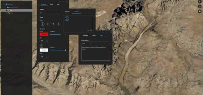
Download for Free – Esri Release ArcGIS Earth 1.4
Recently Esri 3D team has announced the release of ArcGIS Earth 1.4. ArcGIS Earth 1.4 introduces great new features that will enhance workflows for visualizing data, accessing portals, and sharing across
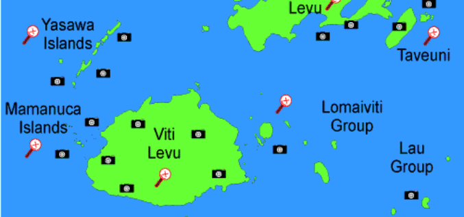
Fiji Adopted GIS to Help in Improving Natural Disaster Risk Development
According to the recent news reported by The Fiji Times Online, the office of the Commissioner Western will have access to information which will help in the visualization of the

Mapping & Geospatial Industry in India to Grow Manifold in a Decade
Hyderabad – PTI – The mapping and geospatial technology area in the country are estimated to witness business of a whopping Rs 1 lakh crore in the next 10 years, Surveyor

HazardHub Democratizes Hazard Risk Data with New API
For the first time, geographic risk data is available via a real-time API for inclusion to clients’ internal systems. San Diego, CA (PRWEB) January 17, 2017 – HazardHub, the nation’s first
