
Tag "Indian Regional Navigation Satellite System"
GIS
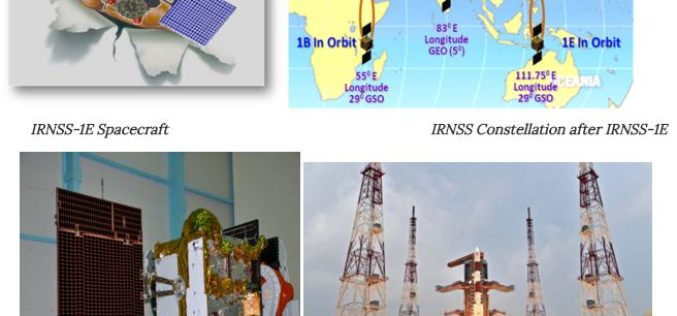
Towards Self Reliance in Satellite Navigation-IRNSS
Indian Regional Navigation Spacecraft System (IRNSS) is the Indian navigation system which envisages establishment of regional navigation system using a combination of GEO and GSO spacecraft. IRNSS system is expected

Global Positioning System
India, Russia to Work Jointly on Development of Navigation Platform, GIS
Strengthening their cooperation in the field of space technology, Russia and India today signed an agreement which will enable joint development and implementation of projects like navigation platform and Geographical Information System in India.

Global Positioning System
India’s PSLV-C24 Lifted off Sucessfully IRNSS-1B Spacecraft
The PSLV-C24 lifted off at 17:14 hrs (IST) on board with IRNSS-1B spacecraft. IRNSS-1B is the second satellite of India’s national programme Indian Regional Navigation Satellite System (IRNSS). IRNSS system will
