
Tag "VRS"

CORS Network to Complete Digital Land Resurvey in Kerala
Kerala State Government has given a nod to extended Digital Land Resurvey for 1,550 villages at cost of ₹807.98-crore. The project is expected to complete the resurvey of land over

Trimble VRS Now Correction Services Now Available in Norway
Trimble has announced the expansion of its VRS Now® correction services across mainland Norway and most outer islands.

Errors can be Reduced in VRS
Using the concept of the virtual reference stations, certain systematic errors can be reduced considerably: 1. Ionosphere One of the main sources of errors is the Ionosphere . The electrons
Challenges and Benefits of VRS
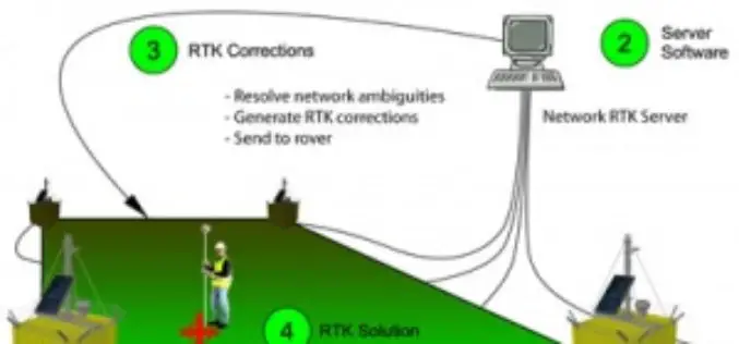
The main purpose of a VRS station is to reduce the baseline distance between the rover and the reference station in order to efficiently remove spatially correlated errors using differential
What is Virtual Reference Station?
A virtual reference station is an imaginary, unoccupied reference station which is only a few meters from the RTK user. For this position, observation data are created from the data
